Datei:Wilderness May5 0700.png
Zur Navigation springen
Zur Suche springen
Größe dieser Vorschau: 800 × 324 Pixel. Weitere Auflösungen: 320 × 130 Pixel | 640 × 259 Pixel | 1.024 × 415 Pixel | 1.280 × 518 Pixel | 2.719 × 1.101 Pixel
Originaldatei (2.719 × 1.101 Pixel, Dateigröße: 636 KB, MIME-Typ: image/png)
![]()
Diese Datei und die Informationen unter dem roten Trennstrich werden aus dem zentralen Medienarchiv Wikimedia Commons eingebunden.
![]()
| Beschreibung |
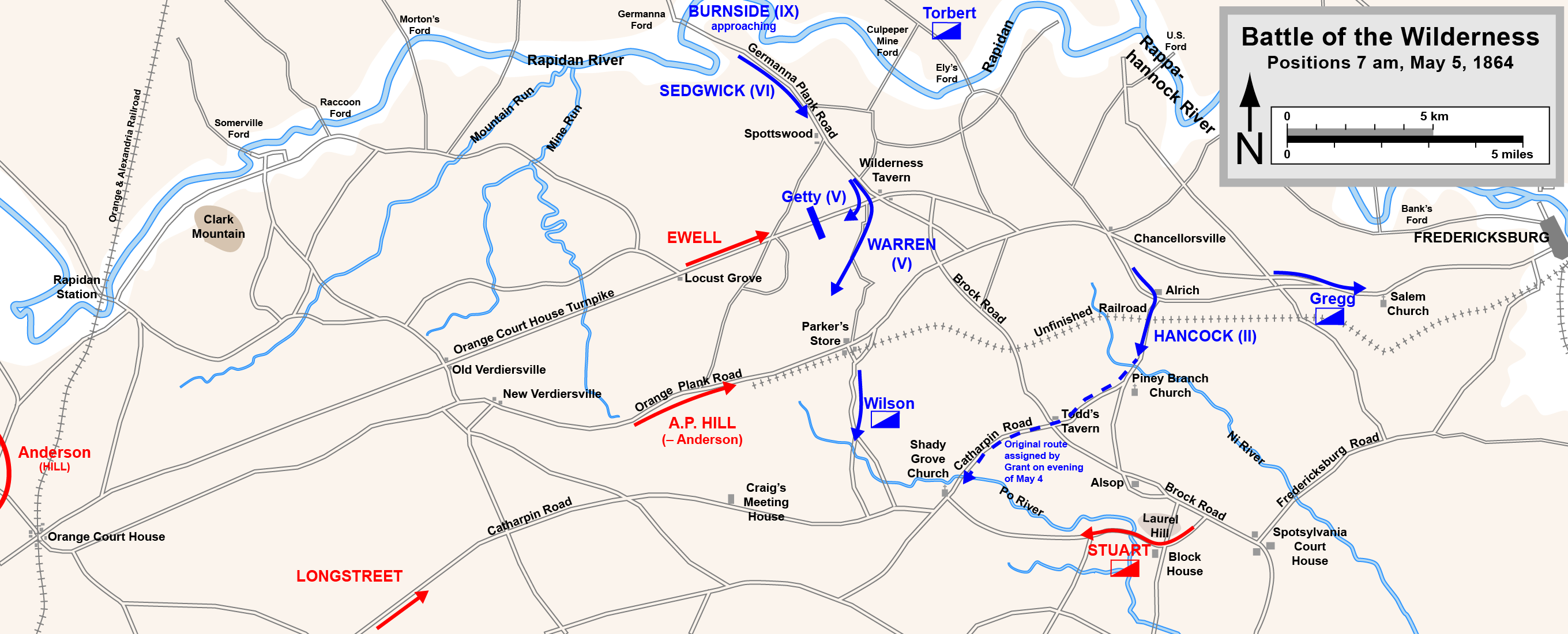
English: Map of the initial positions in the Battle of the Wilderness of the American Civil War.
Drawn in Adobe Illustrator CS5 by Hal Jespersen. Graphic source file is available at http://www.posix.com/CWmaps/ Diese Datei ist unter der Creative-Commons-Lizenz „Namensnennung 3.0 nicht portiert“ lizenziert. Namensnennung: Map by Hal Jespersen, www.posix.com/CW
|
| Datum | |
| Quelle | Eigenes Werk |
| Urheber | Hlj |
Dateiversionen
Klicke auf einen Zeitpunkt, um diese Version zu laden.
| Version vom | Vorschaubild | Maße | Benutzer | Kommentar | |
|---|---|---|---|---|---|
| aktuell | 22:10, 17. Mär. 2011 | 2.719 × 1.101 (636 KB) | Hlj | Minor graphical changes to conform to new ACW map style for roads and rivers. Same license. | |
| 02:48, 25. Okt. 2010 | 2.719 × 1.101 (483 KB) | Hlj | {{Information |Description={{en|1=Map of the initial positions in the Battle of the Wilderness of the American Civil War. Drawn in Adobe Illustrator CS5 by Hal Jespersen. Graphic source file is available at http://www.posix.com/CWmaps/ {{cc-by-3.0|Map by |
Dateiverwendung
Die folgenden 3 Seiten verwenden diese Datei:
Globale Dateiverwendung
Die nachfolgenden anderen Wikis verwenden diese Datei:
- Verwendung auf es.wikipedia.org
- Verwendung auf hu.wikipedia.org
- Verwendung auf hy.wikipedia.org
- Verwendung auf nl.wikipedia.org