Datei:Larose Louisiana aerial view.jpg
Zur Navigation springen
Zur Suche springen

Größe dieser Vorschau: 800 × 533 Pixel. Weitere Auflösungen: 320 × 213 Pixel | 640 × 427 Pixel | 1.024 × 683 Pixel | 1.500 × 1.000 Pixel
Originaldatei (1.500 × 1.000 Pixel, Dateigröße: 278 KB, MIME-Typ: image/jpeg)
![]()
Diese Datei und die Informationen unter dem roten Trennstrich werden aus dem zentralen Medienarchiv Wikimedia Commons eingebunden.
![]()
| Beschreibung |
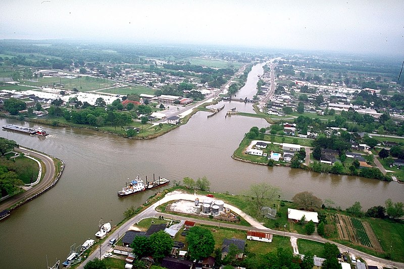
English: Aerial view of the intersection of Bayou Lafourche and the Gulf Intracoastal Waterway at Larose, Louisiana, USA. The waterway runs left–right across the photograph and the bayou runs off into the distance at the top. The U.S. Army Corps of Engineers has installed a floodgate on the bayou, visible at center. |
|||
| Datum | ||||
| Quelle |
U.S. Army Corps of Engineers Digital Visual Library Image page Image description page Digital Visual Library home page |
|||
| Urheber | Arthur Belala, U.S. Army Corps of Engineers | |||
| Genehmigung (Weiternutzung dieser Datei) |
|
|||
| Ort | Larose, Louisiana, USA |
| Kameraposition | | Dieses und weitere Bilder auf OpenStreetMap |
|---|
Dateiversionen
Klicke auf einen Zeitpunkt, um diese Version zu laden.
| Version vom | Vorschaubild | Maße | Benutzer | Kommentar | |
|---|---|---|---|---|---|
| aktuell | 18:28, 1. Apr. 2007 | | 1.500 × 1.000 (278 KB) | DanMS | {{Information | Description = {{en|Aerial view of the intersection of Bayou Lafourche and the Gulf Intracoastal Waterway at Larose, Louisiana, USA. The bayou runs left–right across the photograph and the waterway runs off into the distance at the top |
Dateiverwendung
Die folgende Seite verwendet diese Datei:
Globale Dateiverwendung
Die nachfolgenden anderen Wikis verwenden diese Datei:
- Verwendung auf ar.wikipedia.org
- Verwendung auf azb.wikipedia.org
- Verwendung auf ca.wikipedia.org
- Verwendung auf ceb.wikipedia.org
- Verwendung auf ce.wikipedia.org
- Verwendung auf en.wikipedia.org
- Verwendung auf es.wikipedia.org
- Verwendung auf fa.wikipedia.org
- Verwendung auf fr.wikipedia.org
- Verwendung auf it.wikipedia.org
- Verwendung auf ja.wikipedia.org
- Verwendung auf lld.wikipedia.org
- Verwendung auf pl.wikipedia.org
- Verwendung auf pt.wikipedia.org
- Verwendung auf sh.wikipedia.org
- Verwendung auf sr.wikipedia.org
- Verwendung auf tt.wikipedia.org
- Verwendung auf uk.wikipedia.org
- Verwendung auf www.wikidata.org
- Verwendung auf zh-min-nan.wikipedia.org
- Verwendung auf zh.wikipedia.org