Datei:USDA Hardiness zone map.jpg
Zur Navigation springen
Zur Suche springen
Größe dieser Vorschau: 601 × 599 Pixel. Weitere Auflösungen: 241 × 240 Pixel | 481 × 480 Pixel | 770 × 768 Pixel | 1.027 × 1.024 Pixel | 2.054 × 2.048 Pixel | 4.014 × 4.002 Pixel
Originaldatei (4.014 × 4.002 Pixel, Dateigröße: 5,92 MB, MIME-Typ: image/jpeg)
![]()
Diese Datei und die Informationen unter dem roten Trennstrich werden aus dem zentralen Medienarchiv Wikimedia Commons eingebunden.
![]()
Beschreibung
| Beschreibung |
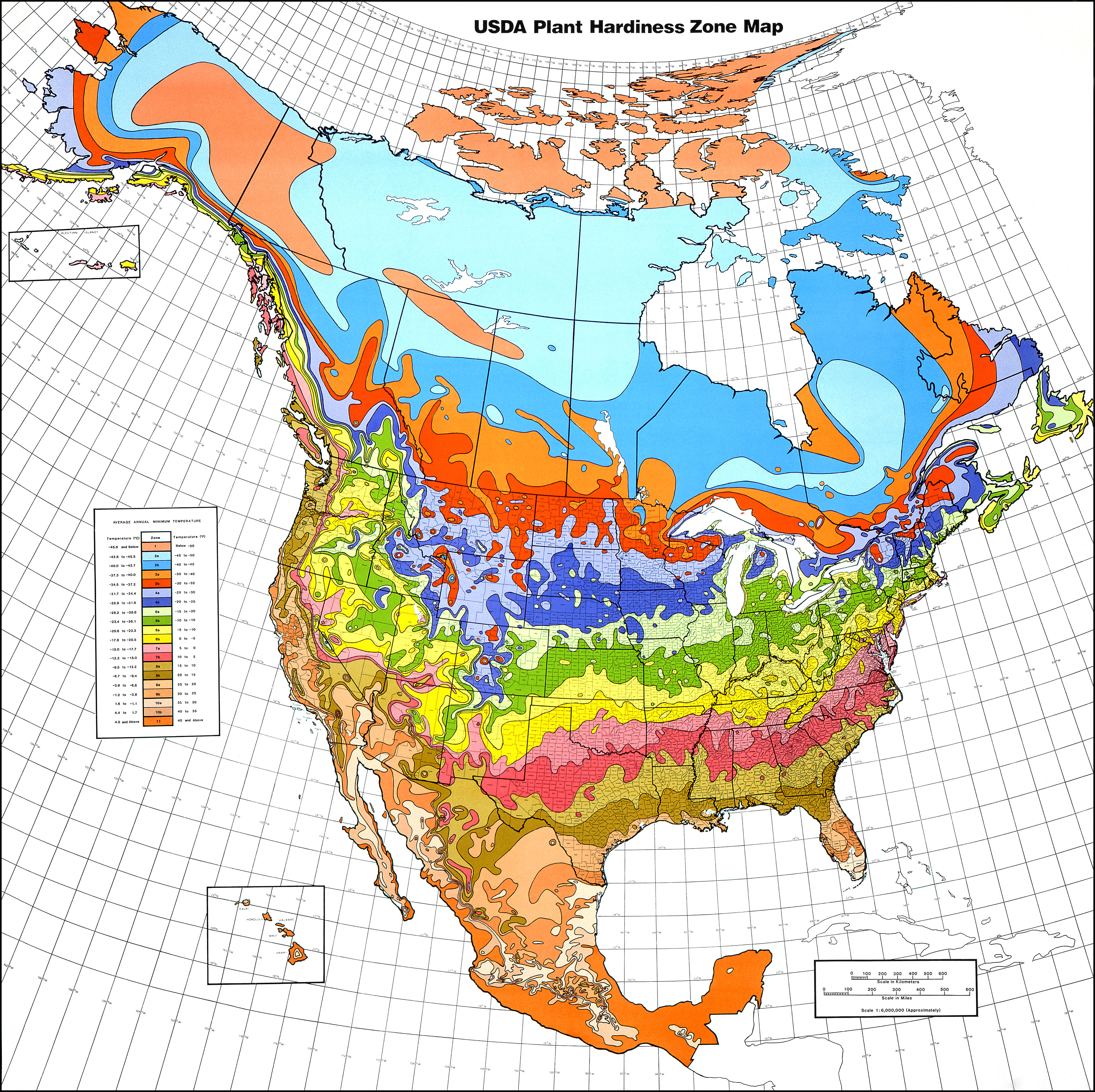
English: USDA Hardiness Zones in North America.
Albers equal area projection, standard parallels of 29.5°N and 45.5°N, scale 1 : 6,000,000 (approx.)
118 × 116 cm (folded: 30 × 21 cm) |
| Datum | 1990, copied 2006-12-31 |
| Quelle | USDA plant hardiness zone map 1990 (USDA Miscellaneous Publication No. 1475) ISBN: 0160187478, USDA website |
| Urheber |
Henry M. Cathey while Director, U.S. National Arboretum, Agricultural Research Service, U.S. Department of Agriculture, Washington, DC 20002
|
| Genehmigung (Weiternutzung dieser Datei) |
Public Domain |
| Andere Versionen | File:USDAplanthardiness.jpg (with a bit of frame) |
Lizenz
This image or file is a work of a United States Department of Agriculture employee, taken or made as part of that person's official duties. As a work of the U.S. federal government, the image is in the public domain.
|
 |
Dateiversionen
Klicke auf einen Zeitpunkt, um diese Version zu laden.
| Version vom | Vorschaubild | Maße | Benutzer | Kommentar | |
|---|---|---|---|---|---|
| aktuell | 02:21, 22. Jan. 2013 | | 4.014 × 4.002 (5,92 MB) | Mapmarks | printable size, ca 4000 × 4000 px download from http://planthardiness.ars.usda.gov/PHZMWeb/Images/northamerica.jpg |
| 02:49, 15. Okt. 2008 |  | 588 × 587 (238 KB) | Omegatron | perspective skew and crop - way too low resolution, though [using an external editor] | |
| 17:14, 31. Dez. 2006 |  | 620 × 603 (165 KB) | SB Johnny | {{Information |Description=USDA Hardiness Zones in the US |Source=USDA website: http://www.usna.usda.gov/Hardzone/ushzmap.html |Date=copied 2006-12-31 |Author= |Permission=Public Domain |other_versions= }} {{PD-USGov}} |
Dateiverwendung
Keine Seiten verwenden diese Datei.
Globale Dateiverwendung
Die nachfolgenden anderen Wikis verwenden diese Datei:
- Verwendung auf ca.wikipedia.org
- Verwendung auf en.wikipedia.org
- Verwendung auf en.wikibooks.org
- Verwendung auf et.wikipedia.org
- Verwendung auf fa.wikipedia.org
- Verwendung auf fi.wikipedia.org
- Verwendung auf fr.wikipedia.org
- Verwendung auf he.wikipedia.org
- Verwendung auf hu.wikipedia.org
- Verwendung auf pl.wikipedia.org
- Verwendung auf zh.wikipedia.org