Datei:USA North Dakota relief location map.jpg
Zur Navigation springen
Zur Suche springen

Größe dieser Vorschau: 800 × 594 Pixel. Weitere Auflösungen: 320 × 237 Pixel | 640 × 475 Pixel | 1.024 × 760 Pixel | 1.280 × 950 Pixel | 2.668 × 1.980 Pixel
Originaldatei (2.668 × 1.980 Pixel, Dateigröße: 2,16 MB, MIME-Typ: image/jpeg)
![]()
Diese Datei und die Informationen unter dem roten Trennstrich werden aus dem zentralen Medienarchiv Wikimedia Commons eingebunden.
![]()
Beschreibung
| Beschreibung |
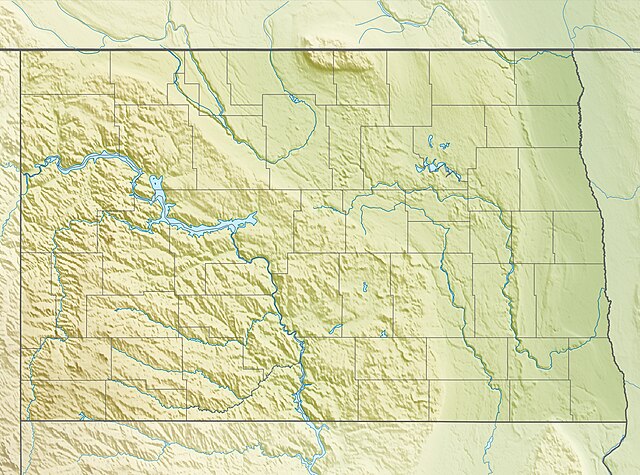
Quadratische Plattkarte, N-S-Streckung 150.0 %. Geographische Begrenzung der Karte:
Equirectangular projection, N/S stretching 150.0 %. Geographic limits of the map:
|
| Datum | |
| Quelle |
Eigenes Werk, using
|
| Urheber | Carport |
| Genehmigung (Weiternutzung dieser Datei) |
Diese Datei ist unter der Creative-Commons-Lizenz „Namensnennung – Weitergabe unter gleichen Bedingungen 3.0 nicht portiert“ lizenziert.
|
| Andere Versionen |
|

Dateiversionen
Klicke auf einen Zeitpunkt, um diese Version zu laden.
| Version vom | Vorschaubild | Maße | Benutzer | Kommentar | |
|---|---|---|---|---|---|
| aktuell | 23:30, 30. Nov. 2012 | | 2.668 × 1.980 (2,16 MB) | Carport | == {{int:filedesc}} == {{Information |Description= {{de|Physische Positionskarte von North Dakota, USA}} Quadratische Plattkarte, N-S-Streckung 150.0 %. Geographische Begrenzung der Karte: * N: 49.4° N * S: 45.5° N * ... |
Dateiverwendung
Die folgenden 24 Seiten verwenden diese Datei:
- Beaver Lake State Park
- Cross Ranch State Park
- Devils Lake (See, North Dakota)
- Fort Abraham Lincoln
- Fort Ransom State Park
- Fort Rice
- Fort Stevenson State Park
- Hi-Line Railroad Bridge
- Icelandic State Park
- KABU
- KEYA
- KFGO
- KMAV
- KMHA
- KTGO
- KVLY-Mast
- KXJB-TV-Mast
- Lake Sakakawea
- Lewis and Clark State Park (North Dakota)
- Little Missouri State Park
- Spirit Lake North Dakota
- White Butte
- Wikipedia:Kartenwerkstatt/Positionskarten/Nordamerika
- Vorlage:Positionskarte USA North Dakota
Globale Dateiverwendung
Die nachfolgenden anderen Wikis verwenden diese Datei:
- Verwendung auf ar.wikipedia.org
- Verwendung auf azb.wikipedia.org
- Verwendung auf az.wikipedia.org
- Verwendung auf be-tarask.wikipedia.org
- Verwendung auf bg.wikipedia.org
- Verwendung auf bn.wikipedia.org
- Verwendung auf ca.wikipedia.org
- Verwendung auf ceb.wikipedia.org
- Verwendung auf ce.wikipedia.org
- Verwendung auf cs.wikipedia.org
- Verwendung auf de.wikivoyage.org
- Verwendung auf el.wikipedia.org
- Verwendung auf en.wikipedia.org
- Fargo, North Dakota
- Wahpeton, North Dakota
- Belcourt, North Dakota
- Minot Air Force Base
- Lake Sakakawea
- Garrison Dam
- Little Missouri River (North Dakota)
- White Butte (North Dakota)
- Devils Lake (North Dakota)
- Minot International Airport
- Jamestown Regional Airport
- Grand Forks International Airport
- Devils Lake Regional Airport
- Dickinson Theodore Roosevelt Regional Airport
- Bismarck Municipal Airport
- Theodore Roosevelt National Park
- Fort Abraham Lincoln
- Fargodome
- Sheyenne National Grassland
- Boundary Lake
- Scheels Center
- Gwinner–Roger Melroe Field
- Bottineau Winter Park
Weitere globale Verwendungen dieser Datei anschauen.