Category:Alberndorf im Pulkautal Pfarrkirche
Jump to navigation
Jump to search
| Object location | | View all coordinates using: OpenStreetMap |
|---|
church building in Lower Austria, Austria  | |||||
| Upload media | |||||
| Instance of | |||||
|---|---|---|---|---|---|
| Named after | |||||
| Location | Alberndorf im Pulkautal, Hollabrunn District, Lower Austria, Austria | ||||
| Street address |
| ||||
| Heritage designation | |||||
 | |||||
Media in category "Alberndorf im Pulkautal Pfarrkirche"
The following 6 files are in this category, out of 6 total.
-
 Alberndorf Pfarrkirche.jpg 1,942 × 2,910; 3.64 MB
-
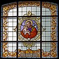 Kirche 11691 Buntglasfenster in A-2054 Alberndorf Pulkautal (01).jpg 2,311 × 2,312; 1.8 MB
-
 Kirche 11691 Buntglasfenster in A-2054 Alberndorf Pulkautal (02).jpg 2,434 × 2,347; 1.66 MB
-
 Kirche 11691 Buntglasfenster in A-2054 Alberndorf Pulkautal (03).jpg 2,468 × 2,379; 1.71 MB
-
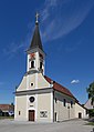 Kirche 11691 in A-2054 Alberndorf im Pulkautal (02).jpg 3,444 × 4,836; 1.81 MB
-
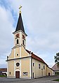 Kirche 11691 in A-2054 Alberndorf im Pulkautal.jpg 3,513 × 4,990; 2.06 MB
.jpg)
.jpg)
.jpg)
.jpg)
