Category:Alter Friedhof und gotischer Bau, Sankt Peter ob Radenthein
Jump to navigation
Jump to search
| Object location | | View all coordinates using: OpenStreetMap |
|---|
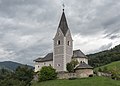
cemetery in Radenthein, Austria  | |||||
| Upload media | |||||
| Instance of | |||||
|---|---|---|---|---|---|
| Location | Radenthein, Spittal an der Drau District, Carinthia, Austria | ||||
| Heritage designation | |||||
 | |||||
Media in category "Alter Friedhof und gotischer Bau, Sankt Peter ob Radenthein"
The following 18 files are in this category, out of 18 total.
-
 Radenthein Sankt Peter alter Friedhof und gotischer Bau 17092015 7498.jpg 7,360 × 4,912; 22.13 MB
-
 Radenthein Sankt Peter alter Friedhof und gotischer Bau 17092015 7499.jpg 7,360 × 4,912; 20.69 MB
-
 Radenthein Sankt Peter alter Friedhof und gotischer Bau 17092015 7506.jpg 7,360 × 4,912; 22.22 MB
-
 Radenthein Sankt Peter alter Friedhof und gotischer Bau 17092015 7507.jpg 7,255 × 4,842; 20.99 MB
-
 Radenthein Sankt Peter alter Friedhof und gotischer Bau 17092015 7509.jpg 6,496 × 3,826; 13.9 MB
-
 Radenthein Sankt Peter alter Friedhof und gotischer Bau 17092015 7510.jpg 7,360 × 4,912; 18.99 MB
-
 Radenthein Sankt Peter alter Friedhof und gotischer Bau 17092015 7511.jpg 7,360 × 4,912; 15.55 MB
-
 Radenthein Sankt Peter alter Friedhof und gotischer Bau 17092015 7512.jpg 7,360 × 4,912; 17.45 MB
-
 Radenthein Sankt Peter alter Friedhof und gotischer Bau 17092015 7513.jpg 7,360 × 4,912; 18.25 MB
-
 Radenthein Sankt Peter alter Friedhof und gotischer Bau 17092015 7514.jpg 7,360 × 4,912; 19.14 MB
-
 Radenthein Sankt Peter alter Friedhof und gotischer Bau 17092015 7515.jpg 7,360 × 4,912; 22.63 MB
-
 Radenthein Sankt Peter alter Friedhof und gotischer Bau 17092015 7516.jpg 7,360 × 4,912; 22.31 MB
-
 Radenthein Sankt Peter gotischer Bau und Pfarkirche hl. Petrus 17092015 7503.jpg 7,360 × 4,912; 20.26 MB
-
 Radenthein Sankt Peter in Tweng Pfarrkirche 11092011 501.jpg 2,848 × 2,970; 907 KB
-
 Radenthein Sankt Peter in Tweng Pfarrkirche Sankt Peter 17092015 7504.jpg 4,458 × 6,139; 9.68 MB
-
 Radenthein Sankt Peter in Tweng Pfarrkirche Sankt Peter 17092015 7505.jpg 6,471 × 4,615; 9.91 MB
-
 Radenthein Sankt Peter in Tweng Pfarrkirche Sankt Peter 17092015 7544.jpg 6,147 × 4,467; 9.16 MB
-
 Radenthein Sankt Peter alter Friedhof und gotischer Bau 11092011 566.jpg 4,288 × 2,848; 1.98 MB


