Category:Burgruine Ligist
Jump to navigation
Jump to search
| Object location | | View all coordinates using: OpenStreetMap |
|---|
building in Voitsberg District, Austria  | |||||
| Upload media | |||||
| Instance of | |||||
|---|---|---|---|---|---|
| Location | Ligist, Voitsberg District, Styria, Austria | ||||
| Street address |
| ||||
| Heritage designation | |||||
 | |||||
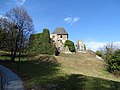
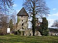
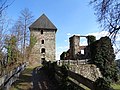
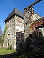
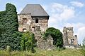
English: Ruins of Castle Ligist in Ligist, Styria, Austria
Deutsch: Burgruine Ligist in Ligist, Steiermark
Media in category "Burgruine Ligist"
The following 64 files are in this category, out of 64 total.
-
 Burg Ligist Anlage 01.jpg 5,184 × 3,888; 8.5 MB
-
 Burg Ligist Anlage 02.jpg 5,184 × 3,888; 8.18 MB
-
 Burg Ligist Anlage 03.jpg 5,184 × 3,888; 9.03 MB
-
 Burg Ligist Anlage 04.jpg 5,184 × 3,888; 7.69 MB
-
 Burg Ligist Anlage 05.jpg 5,184 × 3,888; 8.39 MB
-
 Burg Ligist Anlage 06.jpg 5,184 × 3,888; 8.71 MB
-
 Burg Ligist Anlage 07.jpg 5,184 × 3,888; 9.6 MB
-
 Burg Ligist Anlage 08.jpg 3,888 × 5,184; 8.52 MB
-
 Burg Ligist Anlage 09.jpg 5,184 × 3,888; 8.95 MB
-
 Burg Ligist Anlage 10.jpg 5,184 × 3,888; 8.31 MB
-
 Burg Ligist Anlage 11.jpg 5,184 × 3,888; 7.87 MB
-
 Burg Ligist Anlage 12.jpg 5,184 × 3,888; 8.46 MB
-
 Burg Ligist Anlage 13.jpg 5,184 × 3,888; 7.51 MB
-
 Burg Ligist Anlage 14.jpg 5,184 × 3,888; 8.26 MB
-
 Burg Ligist Anlage 15.jpg 5,184 × 3,888; 7.61 MB
-
 Burg Ligist Bergfried 01.jpg 3,888 × 5,184; 8.11 MB
-
 Burg Ligist Bergfried 02.jpg 3,888 × 5,184; 8.33 MB
-
 Burg Ligist Bergfried 03.jpg 3,888 × 5,184; 8.09 MB
-
 Burg Ligist Bergfried 04.jpg 5,184 × 3,888; 9.11 MB
-
 Burg Ligist Bergfried 05.jpg 3,888 × 5,184; 8.24 MB
-
 Burg Ligist Bergfried 06.jpg 3,888 × 5,184; 7.94 MB
-
 Burg Ligist Bergfried 07.jpg 3,888 × 5,184; 7.67 MB
-
 Burg Ligist Bergfried 08.jpg 3,888 × 5,184; 8.22 MB
-
 Burg Ligist Bergfried 09.jpg 3,888 × 5,184; 8.52 MB
-
 Burg Ligist Bergfried Fenster.jpg 3,888 × 5,184; 8.94 MB
-
 Burg Ligist Bergfried Keller.jpg 5,184 × 3,888; 5.24 MB
-
 Burg Ligist Bergfried Kellerzugang.jpg 3,888 × 5,184; 7.44 MB
-
 Burg Ligist Bergfried Mauerdetail.jpg 5,184 × 3,888; 5.11 MB
-
 Burg Ligist Bergfried Rundmauer.jpg 3,888 × 5,184; 9.68 MB
-
 Burg Ligist Brücke 01.jpg 5,184 × 3,888; 8.99 MB
-
 Burg Ligist Brücke 02.jpg 5,184 × 3,888; 8.83 MB
-
 Burg Ligist Brücke 03.jpg 5,184 × 3,888; 9.63 MB
-
 Burg Ligist Brücke 04.jpg 5,184 × 3,888; 8.93 MB
-
 Burg Ligist Infotafel.jpg 3,888 × 5,184; 6.96 MB
-
 Burg Ligist Otto Piper.jpg 475 × 358; 67 KB
-
 Burg Ligist Palas 01.jpg 5,184 × 3,888; 8.57 MB
-
 Burg Ligist Palas 02.jpg 5,184 × 3,888; 8.88 MB
-
 Burg Ligist Palas 03.jpg 3,888 × 5,184; 9.35 MB
-
 Burg Ligist Palas 04.jpg 3,888 × 5,184; 8.1 MB
-
 Burg Ligist Palas Ringmauer 01.jpg 5,184 × 3,888; 8.71 MB
-
 Burg Ligist Palas Ringmauer 02.jpg 3,888 × 5,184; 8.76 MB
-
 Burg Ligist Palas Ringmauer 03.jpg 5,184 × 3,888; 8.28 MB
-
 Burg Ligist Palas Ringmauer 04.jpg 3,888 × 5,184; 8.76 MB
-
 Burg Ligist Palas Ringmauer 05.jpg 5,184 × 3,888; 8.2 MB
-
 Burg Ligist Ringmauer Gebäude 01.jpg 5,184 × 3,888; 7.25 MB
-
 Burg Ligist Ringmauer Gebäude 02.jpg 5,184 × 3,888; 8.39 MB
-
 Burg Ligist Ringmauer Gebäude 03.jpg 3,888 × 5,184; 8.3 MB
-
 Burg Ligist Ringmauer Gebäude 04.jpg 5,184 × 3,888; 8.37 MB
-
 Burg Ligist Ringmauer Gebäude 05.jpg 3,888 × 5,184; 8.63 MB
-
 Burg Ligist Ringmauer Gebäude 06.jpg 3,888 × 5,184; 8.22 MB
-
 Burg Ligist Ringmauer Gebäude 07.jpg 5,184 × 3,888; 7.03 MB
-
 Burg Ligist Ringmauer Gebäude 08.jpg 3,888 × 5,184; 6.85 MB
-
 Burg Ligist Ringmauer Gebäude 09.jpg 3,888 × 5,184; 7.7 MB
-
 Burg Ligist Ringmauer Gebäude 10.jpg 3,888 × 5,184; 7.65 MB
-
 Burg Ligist Ringmauer Gebäude 11.jpg 5,184 × 3,888; 7.66 MB
-
 Burg Ligist Ringmauer Gebäude 12.jpg 5,184 × 3,888; 7.63 MB
-
 Burg Ligist Ringmauer Gebäude 13.jpg 5,184 × 3,888; 7.31 MB
-
 Burg Ligist Rondell.jpg 5,184 × 3,888; 8.93 MB
-
 Ligist Burgruine Bergfried.JPG 4,288 × 2,848; 3.94 MB
-
 Ligist Burgruine Brücke Halsgraben.jpg 4,288 × 2,848; 5.95 MB
-
 Ligist Burgruine f.JPG 4,288 × 2,848; 4.54 MB
-
 Ligist Burgruine re.JPG 4,288 × 2,848; 3.06 MB
-
 Ligist Burgruine.JPG 2,948 × 2,238; 3.6 MB
-
 Vischer - Topographia Ducatus Stiria - 237 Ligist bei Voitsberg.jpg 2,563 × 1,581; 2.52 MB


