Category:Felsbildstation Höll
Jump to navigation
Jump to search
| This category shows the protected monument with the number 38119 in Austria. (Commons, de, Wikidata) |
| This category shows the protected monument with the number 38120 in Austria. (Commons, de, Wikidata) |
| Object location | | View all coordinates using: OpenStreetMap |
|---|
 | |||||
| Upload media | |||||
| Instance of | |||||
|---|---|---|---|---|---|
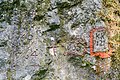
| Location | Spital am Pyhrn, Kirchdorf District, Upper Austria, Austria | ||||
| Street address |
| ||||
| Heritage designation | |||||
 | |||||
Media in category "Felsbildstation Höll"
The following 15 files are in this category, out of 15 total.
-
 Spital aP Felsbilder Höll Bildfelsen II.jpg 6,000 × 4,000; 5.48 MB
-
 Spital aP Felsbilder Höll Bildfelsen IV-1.jpg 6,000 × 4,000; 4.95 MB
-
 Spital aP Felsbilder Höll Bildfelsen IV-2.jpg 6,000 × 4,000; 5.5 MB
-
 Spital aP Felsbilder Höll Bildfelsen IV-3.jpg 6,000 × 4,000; 5.18 MB
-
 Spital aP Felsbilder Höll Bildfelsen IX-1.jpg 6,000 × 4,000; 5.64 MB
-
 Spital aP Felsbilder Höll Bildfelsen IX-2.jpg 6,000 × 4,000; 5.35 MB
-
 Spital aP Felsbilder Höll Bildfelsen IX-3.jpg 6,000 × 4,000; 5.45 MB
-
 Spital aP Felsbilder Höll Bildfelsen V-1.jpg 6,000 × 4,000; 5.7 MB
-
 Spital aP Felsbilder Höll Bildfelsen V-2.jpg 6,000 × 4,000; 5.39 MB
-
 Spital aP Felsbilder Höll Bildfelsen VIII.jpg 6,000 × 4,000; 5.29 MB
-
 Spital aP Felsbilder Höll Durchkriechstein Bildfelsen I-1.jpg 6,000 × 4,000; 5.78 MB
-
 Spital aP Felsbilder Höll Durchkriechstein Bildfelsen I-2.jpg 5,578 × 3,719; 5.81 MB
-
 Spital aP Felsbilder Höll Durchkriechstein Bildfelsen I-3.jpg 5,696 × 3,797; 5.61 MB
-
 Spital aP Felsbilder Höll Durchkriechstein Bildfelsen I-4.jpg 4,000 × 6,000; 5.73 MB
-
 Spital aP Felsbilder Höll Markierungsfelsen Bildfelsen VII.jpg 6,000 × 4,000; 5.02 MB


