Category:Hickelgasse 11
Jump to navigation
Jump to search
| Object location | | View all coordinates using: OpenStreetMap |
|---|
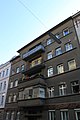
building in Penzing, Austria  | |||||
| Upload media | |||||
| Instance of | |||||
|---|---|---|---|---|---|
| Location | |||||
| Street address |
| ||||
| Located on street |
| ||||
| Heritage designation | |||||
 | |||||
Deutsch: Kommunaler Wohnbau, Hickelgasse 11, 1140 Wien

Media in category "Hickelgasse 11"
The following 3 files are in this category, out of 3 total.
-
 Hickelgasse 11 Ansicht 1.jpg 7,190 × 3,456; 8.14 MB
-
 Hickelgasse 11 Ansicht 2.JPG 2,839 × 4,258; 3.13 MB
-
 Kommunaler Wohnbau Hickelgasse 11.jpg 3,168 × 4,752; 4.77 MB

