Category:Karner hl. Michael, Radsberg (Ebenthal in Kärnten)
Jump to navigation
Jump to search
| Object location | | View all coordinates using: OpenStreetMap |
|---|
 | |||||
| Upload media | |||||
| Instance of | |||||
|---|---|---|---|---|---|
| Location | Ebenthal in Kärnten, Klagenfurt-Land District, Carinthia, Austria | ||||
| Heritage designation | |||||
 | |||||
Media in category "Karner hl. Michael, Radsberg (Ebenthal in Kärnten)"
The following 25 files are in this category, out of 25 total.
-
 Ebenthal Radsberg 1 Pfarrhof und Pfarrkirche hl. Lambert mit Karner 12062019 6735.jpg 6,488 × 4,458; 14.06 MB
-
 Ebenthal Radsberg Aufbahrungshalle Pfarrhof und Pfarrkirche 13022010 494.jpg 4,256 × 2,832; 3.7 MB
-
 Ebenthal Radsberg Aufbahrungshalle Pfarrhof und Pfarrkirche 13022010 7698.jpg 4,222 × 2,784; 4.65 MB
-
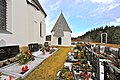
 Ebenthal Radsberg Friedhof Karner 13022010 776.jpg 2,848 × 4,288; 5.85 MB
-
 Ebenthal Radsberg Friedhof Karner hl. Michael Apsis SO-Ansicht 6763.jpg 4,912 × 7,360; 23.47 MB
-
 Ebenthal Radsberg Friedhof Karner hl. Michael W-Ansicht 12062019 6752.jpg 7,360 × 4,912; 18.76 MB
-
 Ebenthal Radsberg Friedhof Karner hl. Michael W-Ansicht 12062019 6758.jpg 4,871 × 7,360; 20.94 MB
-
 Ebenthal Radsberg Friedhof Karner hl. Michael W-Ansicht 12062019 6759.jpg 4,912 × 7,360; 18.08 MB
-
 Ebenthal Radsberg Friedhof Karner hl. Michael W-Ansicht 13082015 6625.jpg 4,752 × 7,187; 16.91 MB
-
 Ebenthal Radsberg Friedhof romanischer Karner 13 JH 100120112 221.jpg 4,256 × 2,832; 2.41 MB
-
 Ebenthal Radsberg Friedhof romanischer Karner 13 JH 100120112 222.jpg 2,832 × 4,256; 2.48 MB
-
 Ebenthal Radsberg Friedhof romanischer Karner 13 JH 100120112 223.jpg 2,816 × 3,544; 1.86 MB
-
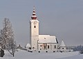
 Ebenthal Radsberg Pfarrhof und Pfarrkirche hl. Lambert 20052010 6107.jpg 4,288 × 2,848; 7.17 MB
-
 Ebenthal Radsberg Pfarrkirche hl Lambert 13022010 1675.jpg 4,288 × 3,076; 6.01 MB
-
 Ebenthal Radsberg Pfarrkirche hl Lambert 13022010 7684.jpg 4,084 × 2,797; 4.76 MB
-
 Ebenthal Radsberg Pfarrkirche hl. Lambert 13082015 6607.jpg 7,360 × 4,912; 11.37 MB
-
 Ebenthal Radsberg Pfarrkirche hl. Lambert 13082015 6609.jpg 7,360 × 4,912; 10.01 MB
-
 Ebenthal Radsberg Pfarrkirche hl. Lambert 17042007 8253.jpg 3,664 × 2,464; 1.41 MB
-
 Ebenthal Radsberg Pfarrkirche hl. Lambert mit Karner und Pfarrhof 12062019 6743.jpg 7,360 × 4,912; 23.44 MB
-
 Ebenthal Radsberg Pfarrkirche hl. Lambert mit Karner und Pfarrhof 12062019 6744.jpg 7,360 × 4,912; 19.98 MB
-
 Ebenthal Radsberg Pfarrkirche hl. Lambert mit Karner und Pfarrhof 12062019 6746.jpg 7,360 × 4,912; 21.5 MB
-
 Ebenthal Radsberg Pfarrkirche hl. Lambert SO-Ansicht 12062019 6748.jpg 4,841 × 3,209; 11.03 MB
-
 Ebenthal Radsberg Pfarrkirche hl. Lambert SSW-Ansicht 12062019 6739.jpg 6,699 × 4,912; 14.46 MB
-
 Ebenthal Radsberg Friedhof romanischer Karner 13 JH 100120112 224.jpg 2,832 × 3,544; 1.43 MB
-
 Ebenthal Radsberg Friedhof romanischer Karner 13 JH 100120112 225.jpg 2,548 × 3,830; 1.66 MB


