Category:Kurrentgasse 12, Vienna
Jump to navigation
Jump to search
| Object location | | View all coordinates using: OpenStreetMap |
|---|
building in Innere Stadt, Austria  | |||||
| Upload media | |||||
| Instance of | |||||
|---|---|---|---|---|---|
| Location | Innere Stadt, Vienna, Austria | ||||
| Street address |
| ||||
| Heritage designation | |||||
 | |||||
English: Tenement in Vienna, 1st district Kurrentgasse 12
Media in category "Kurrentgasse 12, Vienna"
The following 7 files are in this category, out of 7 total.
-
 1010 Kurrentgasse 12 - Putti mit Greif spielend IMG 0758.jpg 1,200 × 1,600; 325 KB
-
 Autriche Vienne Judenplatz - panoramio.jpg 1,458 × 1,944; 744 KB
-
 Greif-Kurrentgasse-12-Wien.jpg 1,074 × 1,043; 247 KB
-
 Kurrentg 12..jpg 2,136 × 2,848; 1.54 MB
-
 Wien-Kurrentgasse-02-Nr 12-Adler mit Putten-2009-gje.jpg 3,072 × 2,048; 1.24 MB
-
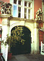 Wohnhaus Kurrentgasse 12 Portal.jpg 988 × 1,384; 387 KB
-
 Wohnhaus Kurrentgasse 12 Stiege.jpg 991 × 655; 218 KB


