Category:Pfarrkirche Obersdorf
Jump to navigation
Jump to search
| Object location | | View all coordinates using: OpenStreetMap |
|---|
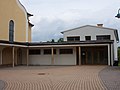
church building in Wolkersdorf im Weinviertel, Austria _-_Kirche.JPG)  | |||||
| Upload media | |||||
| Instance of | |||||
|---|---|---|---|---|---|
| Named after | |||||
| Location | Wolkersdorf im Weinviertel, Mistelbach District, Lower Austria, Austria | ||||
| Street address |
| ||||
| Heritage designation | |||||
 | |||||
Media in category "Pfarrkirche Obersdorf"
The following 19 files are in this category, out of 19 total.
-
 Kirche 12545 Buntglasfenster in A-2120 Obersdorf a.jpg 2,250 × 5,700; 3.17 MB
-
 Kirche 12545 Buntglasfenster in A-2120 Obersdorf b.jpg 3,300 × 4,800; 3.47 MB
-
 Kirche 12545 Buntglasfenster in A-2120 Obersdorf c.jpg 3,300 × 4,800; 3.34 MB
-
 Kirche 12545 Buntglasfenster in A-2120 Obersdorf d.jpg 2,250 × 5,700; 3.18 MB
-
 Kirche 12545 Orgelempore in A-2120 Obersdorf.jpg 6,040 × 3,288; 2.52 MB
-
 Kirche 8687 Seitenaltar in A-2120 Obersdorf.jpg 4,016 × 5,561; 2.91 MB
-
 Kirche hl. Antonius Obersdorf.jpg 1,024 × 768; 537 KB
-
 Kirche Obersdorf.JPG 3,648 × 2,736; 2.58 MB
-
 Obersdorf (Wolkersdorf) - Kirche.JPG 3,386 × 2,395; 7.48 MB
-
 Obersdorf Kirche.JPG 4,288 × 3,216; 5.77 MB
-
 Obersdorf Pfarrkirche 1.JPG 3,216 × 4,288; 3 MB
-
 Pfarrhof Obersdorf.JPG 3,648 × 2,736; 2.6 MB
-
 Pfarrkirche Obersdorf im Weinviertel 01.jpg 4,752 × 3,168; 3.96 MB
-
 Pfarrkirche Obersdorf im Weinviertel 02.jpg 4,752 × 3,168; 4.72 MB
-
 Pfarrkirche Obersdorf im Weinviertel 03.jpg 4,752 × 3,168; 6.13 MB
-
 Pfarrkirche Obersdorf im Weinviertel 04.jpg 4,752 × 3,168; 6.69 MB
-
 Pfarrkirche Obersdorf im Weinviertel 05.jpg 3,168 × 4,752; 5.44 MB
-
 Pfarrkirche Obersdorf im Weinviertel 06.jpg 3,168 × 4,752; 5.02 MB
-
 Pfarrkirche Obersdorf im Weinviertel 07.jpg 4,752 × 3,168; 7.58 MB


