Category:Pfarrkirche Straning
Jump to navigation
Jump to search
| Object location | | View all coordinates using: OpenStreetMap |
|---|
church building in Lower Austria, Austria   | |||||
| Upload media | |||||
| Instance of | |||||
|---|---|---|---|---|---|
| Named after | |||||
| Location | Straning-Grafenberg, Horn District, Lower Austria, Austria | ||||
| Diocese | |||||
| Heritage designation | |||||
 | |||||
Media in category "Pfarrkirche Straning"
The following 17 files are in this category, out of 17 total.
-
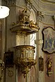
 Pfarrkirche Straning 01.jpg 1,383 × 2,658; 1.94 MB
-
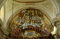
 Pfarrkirche Straning 02.jpg 1,770 × 2,716; 2.69 MB
-
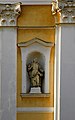
 Pfarrkirche Straning 03.jpg 2,000 × 3,008; 3.22 MB
-
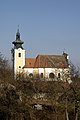
 Pfarrkirche Straning 04.jpg 1,815 × 2,808; 2.71 MB
-
 Pfarrkirche Straning 05.jpg 2,923 × 1,889; 2.99 MB
-
 Pfarrkirche Straning 06.jpg 1,695 × 2,705; 2.7 MB
-
 Pfarrkirche Straning 07.jpg 1,710 × 2,789; 2.21 MB
-
 Pfarrkirche Straning 08.jpg 1,339 × 2,823; 2.34 MB
-
 Pfarrkirche Straning 09.jpg 2,343 × 1,607; 2.39 MB
-
 Pfarrkirche Straning 10.jpg 2,000 × 3,008; 3.51 MB
-
 Pfarrkirche Straning 11.jpg 2,000 × 3,008; 3.34 MB
-
 Pfarrkirche Straning 12.jpg 2,518 × 1,696; 2.47 MB
-
 Pfarrkirche Straning Ambo.jpg 2,000 × 3,008; 3.51 MB
-
 Straning - Kirche, innen.JPG 4,724 × 3,340; 11.93 MB
-
 Straning - Kirche.JPG 2,001 × 3,543; 6.04 MB
-
 Straning Grabmal Tauchner.jpg 2,000 × 3,008; 4.56 MB
-
 Straning Pfarrkirche Mariae Himmelfahrt.jpg 1,336 × 872; 972 KB


