Category:Pfarrkirche hl. Helena, Sittersdorf
Jump to navigation
Jump to search
| Object location | | View all coordinates using: OpenStreetMap |
|---|
parish church and cemetery in Sittersdorf, Austria  | |||||
| Upload media | |||||
| Instance of | |||||
|---|---|---|---|---|---|
| Location | Sittersdorf, Völkermarkt District, Carinthia, Austria | ||||
| Street address |
| ||||
| Heritage designation | |||||
 | |||||
Media in category "Pfarrkirche hl. Helena, Sittersdorf"
The following 10 files are in this category, out of 10 total.
-
 Kath. Pfarrkirche hl. Helena und Friedhof 02.jpg 954 × 1,379; 494 KB
-
 Kath. Pfarrkirche hl. Helena und Friedhof 03.jpg 1,000 × 1,500; 897 KB
-
 Kath. Pfarrkirche hl. Helena und Friedhof.jpg 960 × 1,462; 480 KB
-
 Sittersdorf 1690 Kirche.jpg 4,275 × 3,291; 3.47 MB
-
 Sittersdorf Friedhof Karner 27092012 017.jpg 2,832 × 4,256; 2.03 MB
-
 Sittersdorf Kirche Heilige Helena 17112006 02.jpg 2,400 × 2,508; 664 KB
-
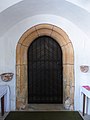 Sittersdorf Kirchenportal.jpg 3,456 × 4,608; 6.1 MB
-
 Sittersdorf Pfarrkirche Heiliger Christophorus 27092012 099.jpg 2,832 × 4,256; 2.31 MB
-
 Sittersdorf Pfarrkirche Wehrfriedhof 27092012 077.jpg 4,256 × 2,832; 2.68 MB
-
 Sittersdorf Römerstein Kirchenvorraum.jpg 4,608 × 3,456; 5.92 MB


