Category:Saint Magdalene Church (Raasdorf)
Jump to navigation
Jump to search
| Object location | | View all coordinates using: OpenStreetMap |
|---|
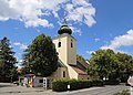
church building in Raasdorf, Austria  | |||||
| Upload media | |||||
| Instance of | |||||
|---|---|---|---|---|---|
| Named after | |||||
| Location | Raasdorf, Gänserndorf District, Lower Austria, Austria | ||||
| Street address |
| ||||
| Heritage designation | |||||
 | |||||
Media in category "Saint Magdalene Church (Raasdorf)"
The following 2 files are in this category, out of 2 total.
-
 Raasdorf - Kirche.JPG 3,150 × 2,246; 5.97 MB
-
 RaasdorfKirche.jpg 640 × 480; 63 KB
