Category:Schloss Limberg, Maissau
Jump to navigation
Jump to search
| Object location | | View all coordinates using: OpenStreetMap |
|---|
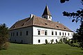
building in Lower Austria, Austria  | |||||
| Upload media | |||||
| Instance of | |||||
|---|---|---|---|---|---|
| Location | Maissau, Hollabrunn District, Lower Austria, Austria | ||||
| Heritage designation | |||||
 | |||||
Deutsch: Gesamtanlage Schloss Limberg samt Nebengebäuden, Mauer, Brunnen und heiligem Florian
Media in category "Schloss Limberg, Maissau"
The following 30 files are in this category, out of 30 total.
-
 GuentherZ 2012-05-19 0009 Limberg Schloss Limberg.jpg 1,800 × 1,205; 1.32 MB
-
 GuentherZ 2012-05-19 0018 Limberg Schloss Limberg.jpg 1,800 × 1,162; 1.71 MB
-
 GuentherZ 2012-05-19 0024 Limberg Schloss Limberg.jpg 1,800 × 1,205; 1.76 MB
-
 Limberg 1570.jpg 2,280 × 1,507; 2.23 MB
-
 Limberg Bandelwerk Fensterlaibung.jpg 1,922 × 2,938; 2.55 MB
-
 Limberg Brunnen.jpg 2,663 × 1,754; 3.04 MB
-
 Limberg Ensemble.jpg 2,829 × 1,942; 3.4 MB
-
 Limberg Florian Detail.jpg 3,008 × 2,000; 3.07 MB
-
 Limberg Florian.jpg 2,000 × 3,008; 4.33 MB
-
 Limberg Fresko1.jpg 3,008 × 2,000; 3.39 MB
-
 Limberg Fresko2.jpg 2,000 × 3,008; 4.38 MB
-
 Limberg Fundament.jpg 2,000 × 3,008; 3.38 MB
-
 Limberg Gewölbe.jpg 1,816 × 2,885; 2.71 MB
-
 Limberg Hof1.jpg 3,008 × 2,000; 3.46 MB
-
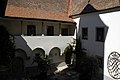 Limberg Hof2.jpg 2,928 × 1,940; 2.93 MB
-
 Limberg Hof3.jpg 2,921 × 1,939; 2.93 MB
-
 Limberg Mauerreste.jpg 1,844 × 2,872; 2.81 MB
-
 Limberg Mäanderfries.jpg 2,970 × 1,900; 3.21 MB
-
 Limberg Presshaus.jpg 2,948 × 1,948; 2.76 MB
-
 Limberg Schloss1.jpg 2,825 × 1,889; 3.22 MB
-
 Limberg Schloss2.jpg 2,393 × 1,575; 2.45 MB
-
 Limberg Schmiedeeisen.jpg 1,938 × 2,950; 3.1 MB
-
 Limberg Schüttkasten.jpg 2,894 × 1,882; 3.09 MB
-
 Limberg Sonnenuhr.jpg 1,938 × 2,950; 3.6 MB
-
 Limberg Steingewändefenster innen.jpg 2,432 × 1,958; 2.47 MB
-
 Limberg Stöckl Detail.jpg 700 × 1,044; 600 KB
-
 Limberg Stöckl.jpg 2,000 × 3,008; 3.49 MB
-
 Limberg Torpfeiler.jpg 1,928 × 2,956; 3.66 MB
-
 Limberg Turm.jpg 1,495 × 2,300; 1.86 MB
-
 Schloss Limberg.png 890 × 724; 1.64 MB


