Datei:Map CZ - district Pribram.PNG
Zur Navigation springen
Zur Suche springen

Größe dieser Vorschau: 800 × 548 Pixel. Weitere Auflösungen: 320 × 219 Pixel | 640 × 439 Pixel | 1.024 × 702 Pixel | 1.281 × 878 Pixel
Originaldatei (1.281 × 878 Pixel, Dateigröße: 37 KB, MIME-Typ: image/png)
![]()
Diese Datei und die Informationen unter dem roten Trennstrich werden aus dem zentralen Medienarchiv Wikimedia Commons eingebunden.
![]()
Beschreibung
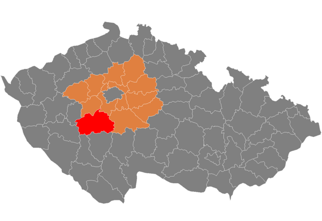
| Beschreibung | Location of Příbram District in Central Bohemian Region and the Czech Republic. |
| Datum | Unbekanntes Datum |
| Quelle | self-made, based on Image:Czech_Republic_districts.png |
| Urheber | Michiel1972 |
Lizenz
| Ich, der Urheberrechtsinhaber dieses Werkes, veröffentliche es als gemeinfrei. Dies gilt weltweit. In manchen Staaten könnte dies rechtlich nicht möglich sein. Sofern dies der Fall ist: Ich gewähre jedem das bedingungslose Recht, dieses Werk für jedweden Zweck zu nutzen, es sei denn, Bedingungen sind gesetzlich erforderlich. |
Dateiversionen
Klicke auf einen Zeitpunkt, um diese Version zu laden.
| Version vom | Vorschaubild | Maße | Benutzer | Kommentar | |
|---|---|---|---|---|---|
| aktuell | 11:11, 5. Okt. 2007 | | 1.281 × 878 (37 KB) | Michiel1972 | {{Information |Description=Locator_maps_of_districts_of_the_Czech_Republic. |Source=self-made, based on Image:Czech_Republic_districts.png |Date= |Author= Michiel1972 }} [[category:Locator_maps_of_districts_of_the_Czech_Republic |
Dateiverwendung
Die folgende Seite verwendet diese Datei:
Globale Dateiverwendung
Die nachfolgenden anderen Wikis verwenden diese Datei:
- Verwendung auf ar.wikipedia.org
- Verwendung auf azb.wikipedia.org
- Verwendung auf bg.wikipedia.org
- Verwendung auf en.wikipedia.org
- Verwendung auf eo.wikipedia.org
- Verwendung auf fa.wikipedia.org
- Verwendung auf fr.wikipedia.org
- Verwendung auf hu.wikipedia.org
- Verwendung auf it.wikipedia.org
- Verwendung auf ka.wikipedia.org
- Verwendung auf ms.wikipedia.org
- Verwendung auf nl.wikipedia.org
- Verwendung auf pl.wikipedia.org
- Verwendung auf pnb.wikipedia.org
- Verwendung auf pt.wikipedia.org
- Příbram (distrito)
- Příbram
- Dobříš
- Sedlčany
- Nová Ves pod Pleší
- Predefinição:Distrito de Příbram
- Březnice (Boêmia Central)
- Nový Knín
- Rožmitál pod Třemšínem
- Sedlec-Prčice
- Jince
- Bezděkov pod Třemšínem
- Bohostice
- Bohutín (Boêmia Central)
- Borotice (Boêmia Central)
- Bratkovice
- Buková u Příbramě
- Bukovany (Příbram)
- Cetyně
- Chotilsko
- Chrást (Příbram)
- Chraštice
- Čenkov
- Čím
- Daleké Dušníky
- Dlouhá Lhota (Příbram)
- Dolní Hbity
- Drahenice
- Drahlín
- Drásov (Boêmia Central)
- Drevníky
- Drhovy
- Dubenec (Boêmia Central)
- Dublovice
- Dubno (Příbram)
- Háje
Weitere globale Verwendungen dieser Datei anschauen.