Datei:BlankMap-USA-states-Canada-provinces, HI closer.svg

Originaldatei (SVG-Datei, Basisgröße: 512 × 512 Pixel, Dateigröße: 104 KB)
![]()
Diese Datei und die Informationen unter dem roten Trennstrich werden aus dem zentralen Medienarchiv Wikimedia Commons eingebunden.
![]()
| Beschreibung |
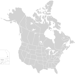
English: Blank SVG map of USA and Canada with state and province borders. Hawaii has been moved closer to the mainland USA to reduce width of image.
Non-contiguous parts of a states/provinces are "grouped" together with the main area of the state/provinces, so any state/provinces can be coloured in completion with one click anywhere on the state/provinces's area. Also, all states/provinces have a "id" attached to them, making them easy to find. Select "find" and then enter in the state/provinces's ISO 3166-2 code in the "id" field to find it. The codes can be found here (Canada) and here (USA). |
| Datum | |
| Quelle |
|
| Urheber | Lokal_Profil |
| Genehmigung (Weiternutzung dieser Datei) |
Diese Datei ist unter der Creative-Commons-Lizenz „Namensnennung – Weitergabe unter gleichen Bedingungen 2.5 generisch“ (US-amerikanisch) lizenziert. Namensnennung: Lokal_Profil
|
| Andere Versionen |
Diese Datei enthält Elemente, die von folgender Datei entnommen oder adaptiert wurden:
The same as this map with the two-letter state or province name label for each one |
Dateiversionen
Klicke auf einen Zeitpunkt, um diese Version zu laden.
| Version vom | Vorschaubild | Maße | Benutzer | Kommentar | |
|---|---|---|---|---|---|
| aktuell | 03:48, 23. Nov. 2020 | | 512 × 512 (104 KB) | Ponderosapine210 | Accidentally uploaded wrong version. Here is the correct one. |
| 03:38, 23. Nov. 2020 |  | 512 × 596 (132 KB) | Ponderosapine210 | Added the prominent islands of Manitoulin (Ontario) and Isle Royale (Michigan) to the Great Lakes. | |
| 00:59, 2. Jun. 2019 |  | 512 × 512 (99 KB) | Fluffy89502 | added territories | |
| 23:18, 8. Dez. 2007 |  | 1.730 × 1.730 (212 KB) | Lokal Profil | Code trimming | |
| 06:21, 3. Jul. 2007 |  | 1.730 × 1.730 (213 KB) | Lokal Profil | {{Information |Description={{en|Blank SVG map of USA and Canada with state and province borders. Hawaii has been moved closer to the mainland USA to reduce width of image.}} Non-contiguous parts of a states/provinces are "grouped" together with the main a |
Dateiverwendung
Keine Seiten verwenden diese Datei.
Globale Dateiverwendung
Die nachfolgenden anderen Wikis verwenden diese Datei:
- Verwendung auf en.wikipedia.org
- Verwendung auf fr.wikipedia.org