Datei:California 60.svg
Zur Navigation springen
Zur Suche springen

Größe der PNG-Vorschau dieser SVG-Datei: 385 × 401 Pixel. Weitere aus SVG automatisch erzeugte PNG-Grafiken in verschiedenen Auflösungen: 230 × 240 Pixel | 461 × 480 Pixel | 737 × 768 Pixel | 983 × 1.024 Pixel | 1.966 × 2.048 Pixel
Originaldatei (SVG-Datei, Basisgröße: 385 × 401 Pixel, Dateigröße: 14 KB)
![]()
Diese Datei und die Informationen unter dem roten Trennstrich werden aus dem zentralen Medienarchiv Wikimedia Commons eingebunden.
![]()
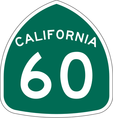
| Beschreibung | Vector image of a 24 in by 25 in (600 mm by 635 mm) California State Route shield. Colors are from [1] (Pantone Green 342), converted to RGB by [2]. The outside border has a width of 1 (1/16 in) and a color of black so it shows up; in reality, signs have no outside border. |
| Datum | |
| Quelle | Made to the specifications of the 1971 Caltrans sign drawing (still in use). Uses the Roadgeek 2005 fonts. (United States law does not permit the copyrighting of typeface designs, and the fonts are meant to be copies of a U.S. Government-produced work anyway.) |
| Urheber | SPUI |
| Andere Versionen |
Diese Datei enthält Elemente, die von folgender Datei entnommen oder adaptiert wurden: |
| SVG‑Erstellung | Dieses Logo wurde mit Adobe Illustrator erstellt. |
This file is in the public domain because it comes from the California Manual on Uniform Traffic Control Devices, sign number G28-2 (CA), which states specifically in its introduction, on page 44 that:
|
Dateiversionen
Klicke auf einen Zeitpunkt, um diese Version zu laden.
| Version vom | Vorschaubild | Maße | Benutzer | Kommentar | |
|---|---|---|---|---|---|
| aktuell | 18:31, 20. Mär. 2006 | | 385 × 401 (14 KB) | SPUI~commonswiki | |
| 15:56, 20. Mär. 2006 |  | 385 × 401 (13 KB) | SPUI~commonswiki | ||
| 15:30, 20. Mär. 2006 | 570 × 2.910 (24 KB) | SPUI~commonswiki | {{spuiother}} 24 in by 25 in (600 mm by 635 mm) California State Route shield, made to the specifications of the [http://www.dot.ca.gov/hq/traffops/signtech/signdel/specs/G28-2.pdf 1971 Caltrans sign drawing] (still in use). Uses the [http://www.triskele. |
Dateiverwendung
Die folgenden 2 Seiten verwenden diese Datei:
Globale Dateiverwendung
Die nachfolgenden anderen Wikis verwenden diese Datei:
- Verwendung auf azb.wikipedia.org
- Verwendung auf az.wikipedia.org
- Verwendung auf ca.wikipedia.org
- Verwendung auf en.wikipedia.org
- U.S. Route 101
- Los Angeles County, California
- San Bernardino County, California
- Greater Los Angeles
- Interstate 10
- Pomona, California
- Interstate 605
- California State Route 91
- Arroyo Seco Parkway
- Interstate 110 and State Route 110 (California)
- Interstate 710 and State Route 710 (California)
- California State Route 57
- Santa Ana Freeway
- Hollywood Freeway
- Interstate 215 (California)
- Santa Ana River
- California State Route 60
- East Los Angeles Interchange
- San Gabriel River (California)
- Four Level Interchange
- Transportation in Los Angeles
- Southern California freeways
- California State Route 39
- California State Route 61
- Eastern California
- California State Route 71
- California State Route 19
- L Line (Los Angeles Metro)
- E Line (Los Angeles Metro)
- Wikipedia:WikiProject U.S. Roads/Redirects/California
- San Bernardino Valley
- California State Route 59
- California State Route 83
- U.S. Route 101 in California
- Interstate 10 in California
- Atlantic Boulevard (Los Angeles County)
- Interstate 15 in California
- List of highways numbered 60
- Interstate 5 in California
- List of state highways in California
- Template:L Line (Los Angeles Metro)
- Template:E Line (Los Angeles Metro)
- Transportation in the Inland Empire
- User:Timsabin/List of HOT and ETL lanes in the United States
- California county routes in zone N
- Riverside County, California
Weitere globale Verwendungen dieser Datei anschauen.