Datei:CanaanEF4.jpg
Zur Navigation springen
Zur Suche springen

Größe dieser Vorschau: 800 × 600 Pixel. Weitere Auflösungen: 320 × 240 Pixel | 640 × 480 Pixel | 1.024 × 768 Pixel | 1.280 × 960 Pixel
Originaldatei (1.280 × 960 Pixel, Dateigröße: 891 KB, MIME-Typ: image/jpeg)
![]()
Diese Datei und die Informationen unter dem roten Trennstrich werden aus dem zentralen Medienarchiv Wikimedia Commons eingebunden.
![]()
Beschreibung
| Beschreibung |
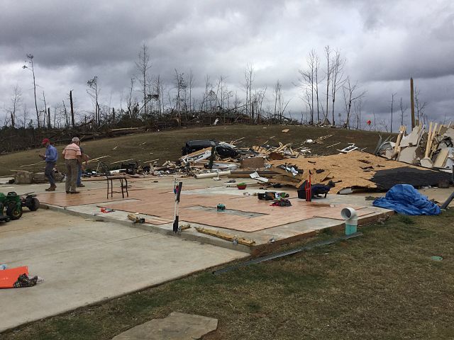
English: EF4 damage to a large house near Canaan, MS. |
| Datum | |
| Quelle | http://services.dat.noaa.gov/arcgis/rest/services/DamageAssessmentToolkit/DamageFlexViewer/FeatureServer/0/883571/attachments/539285 |
| Urheber | NWS Memphis |
Lizenz
This image is in the public domain because it was stored on the web servers of the U.S. National Weather Service. NWS-created images are automatically public domain in the U.S. since the NWS is a part of the U.S. government. However, the NWS sites also host non-NWS images which have been submitted by individuals: these are generally shown as "Courtesy of ...". Such images have explicitly been released to the public domain by the copyright owner as part of the upload process.
As stated at https://www.weather.gov/fsd/disclaimer: "By submitting images, you understand that your image is being released into the public domain. This means that your photo or video may be downloaded, copied, and used by others." Thus, all* images on NWS servers are public domain (including "Courtesy of ..." and “Photo by ...” images) unless specifically stated otherwise through a copyright (©) watermark.
*A deletion discussion in November 2023 ruled that Getty Images on the web servers of NWS, are to be considered copyrighted, even without a copyright (©) watermark and are the sole exception to this rule.
|
Dateiversionen
Klicke auf einen Zeitpunkt, um diese Version zu laden.
| Version vom | Vorschaubild | Maße | Benutzer | Kommentar | |
|---|---|---|---|---|---|
| aktuell | 20:29, 28. Dez. 2015 | | 1.280 × 960 (891 KB) | TornadoInformation12 | {{Information |Description ={{en|1=EF4 damage to a large house near Canaan, MS.}} |Source =http://services.dat.noaa.gov/arcgis/rest/services/DamageAssessmentToolkit/DamageFlexViewer/FeatureServer/0/883571/attachments/539285 |Author =... |
Dateiverwendung
Die folgende Seite verwendet diese Datei:
Globale Dateiverwendung
Die nachfolgenden anderen Wikis verwenden diese Datei:
- Verwendung auf en.wikipedia.org