Datei:Fishermans Wharf aerial view.jpg
Zur Navigation springen
Zur Suche springen

Größe dieser Vorschau: 800 × 534 Pixel. Weitere Auflösungen: 320 × 214 Pixel | 640 × 427 Pixel | 1.024 × 683 Pixel | 1.500 × 1.001 Pixel
Originaldatei (1.500 × 1.001 Pixel, Dateigröße: 639 KB, MIME-Typ: image/jpeg)
![]()
Diese Datei und die Informationen unter dem roten Trennstrich werden aus dem zentralen Medienarchiv Wikimedia Commons eingebunden.
![]()
| Beschreibung |
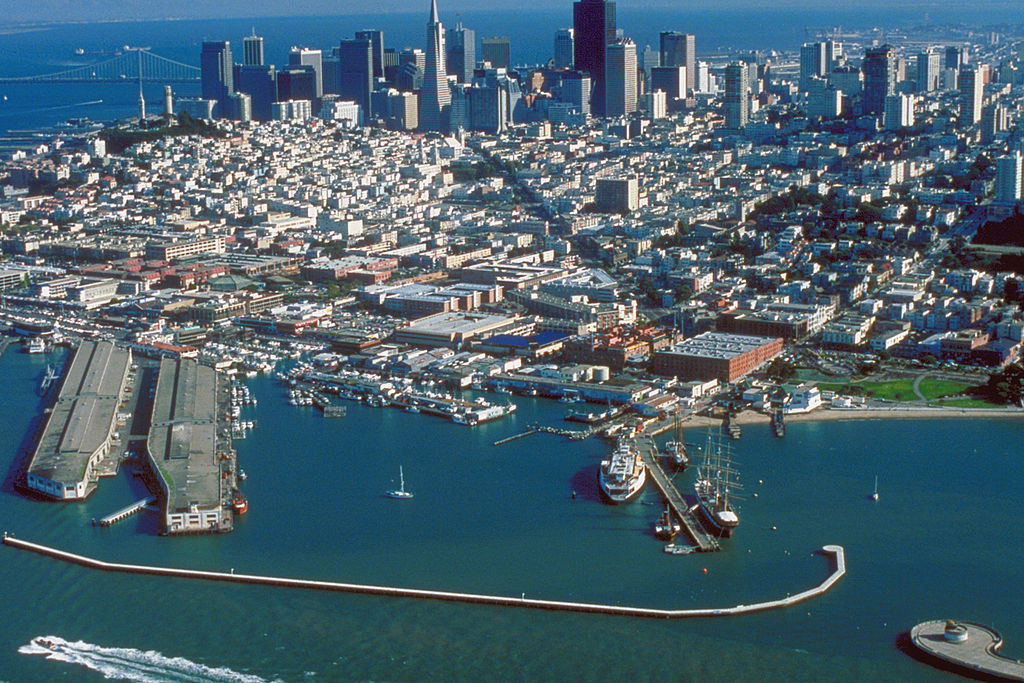
English: Aerial view of Fisherman's Wharf on San Francisco Bay on the north side of San Francisco, California, USA. View is to the southeast.
Coordinates: 37°48′35.83″N 122°25′11.27″W / 37.8099528°N 122.4197972°W |
|||
| Ort | San Francisco, California, USA | |||
| Datum | not specified or unknown | |||
| Quelle |
U.S. Army Corps of Engineers Digital Visual Library Image page Image description page Digital Visual Library home page |
|||
| Urheber | U.S. Army Corps of Engineers, photographer not specified or unknown | |||
| Genehmigung (Weiternutzung dieser Datei) |
|
Dateiversionen
Klicke auf einen Zeitpunkt, um diese Version zu laden.
| Version vom | Vorschaubild | Maße | Benutzer | Kommentar | |
|---|---|---|---|---|---|
| aktuell | 05:49, 4. Mai 2007 | | 1.500 × 1.001 (639 KB) | DanMS | {{Information | Description = {{en|Aerial view of Fisherman's Wharf on San Francisco Bay on the north side of San Francisco, California, USA. View is to the southeast.}} Coordinates: {{Coor dms|37|48|35.83|N|122|25|11.27|W|type:city|display=inline}} | |
Dateiverwendung
Die folgenden 2 Seiten verwenden diese Datei:
Globale Dateiverwendung
Die nachfolgenden anderen Wikis verwenden diese Datei:
- Verwendung auf ar.wikipedia.org
- Verwendung auf bg.wikipedia.org
- Verwendung auf de.wikivoyage.org
- Verwendung auf en.wikipedia.org
- Verwendung auf es.wikipedia.org
- Verwendung auf eu.wikipedia.org
- Verwendung auf fi.wikipedia.org
- Verwendung auf fr.wikipedia.org
- Verwendung auf he.wikivoyage.org
- Verwendung auf hr.wikipedia.org
- Verwendung auf hy.wikipedia.org
- Verwendung auf it.wikinews.org
- Verwendung auf ja.wikipedia.org
- Verwendung auf no.wikipedia.org
- Verwendung auf pt.wikipedia.org
- Verwendung auf ru.wikipedia.org
- Verwendung auf sv.wikipedia.org
- Verwendung auf uk.wikipedia.org
- Verwendung auf vi.wikipedia.org
- Verwendung auf www.wikidata.org
- Verwendung auf zh.wikipedia.org