Datei:Kanawha Ohio confluence.jpg
Zur Navigation springen
Zur Suche springen

Größe dieser Vorschau: 751 × 600 Pixel. Weitere Auflösungen: 301 × 240 Pixel | 601 × 480 Pixel | 962 × 768 Pixel | 1.280 × 1.022 Pixel | 1.500 × 1.198 Pixel
Originaldatei (1.500 × 1.198 Pixel, Dateigröße: 724 KB, MIME-Typ: image/jpeg)
![]()
Diese Datei und die Informationen unter dem roten Trennstrich werden aus dem zentralen Medienarchiv Wikimedia Commons eingebunden.
![]()
Beschreibung
| Beschreibung |
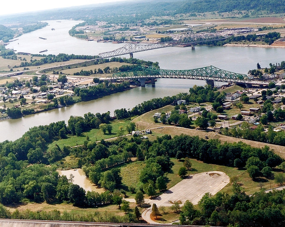
English: The confluence of the Kanawha and Ohio Rivers. The Kanawha River flows in from the left of the picture and joins the Ohio, meandering off in the distance. The town of Point Pleasant, West Virginia is in the foreground on the right. Henderson, West Virginia is on the left. The Ohio River forms the boundary between West Virginia and Ohio. The town of Gallipolis, Ohio lies in the far distance across the Ohio River. The view is to the west-southwest down the river. |
|||
| Datum | vor 2007 | |||
| Quelle |
U.S. Army Corps of Engineers Digital Visual Library Image page Image description page Digital Visual Library home page |
|||
| Urheber | Charles Johnson, U.S. Army Corps of Engineers | |||
| Genehmigung (Weiternutzung dieser Datei) |
|
|||
| Ort | Point Pleasant, West Virginia, USA |
| Kameraposition | | Dieses und weitere Bilder auf OpenStreetMap |
|---|
| Bildnotizen | Diese Datei ist annotiert: Betrachte diese auf Commons. |
Dateiversionen
Klicke auf einen Zeitpunkt, um diese Version zu laden.
| Version vom | Vorschaubild | Maße | Benutzer | Kommentar | |
|---|---|---|---|---|---|
| aktuell | 06:52, 23. Mär. 2007 | | 1.500 × 1.198 (724 KB) | DanMS | {{Information | Description = {{en|The confluence of the Kanawha and Ohio Rivers. The Kanawha River flows in from the left of the picture and joins the Ohio, meandering off in the distance. The town of Point Pleasant, West Virginia is in the foreground |
Dateiverwendung
Die folgenden 2 Seiten verwenden diese Datei:
Globale Dateiverwendung
Die nachfolgenden anderen Wikis verwenden diese Datei:
- Verwendung auf ar.wikipedia.org
- Verwendung auf arz.wikipedia.org
- Verwendung auf ca.wikipedia.org
- Verwendung auf ceb.wikipedia.org
- Verwendung auf ce.wikipedia.org
- Verwendung auf cy.wikipedia.org
- Verwendung auf dag.wikipedia.org
- Verwendung auf en.wikipedia.org
- Verwendung auf en.wikivoyage.org
- Verwendung auf es.wikipedia.org
- Verwendung auf eu.wikipedia.org
- Verwendung auf fa.wikipedia.org
- Verwendung auf fr.wikipedia.org
- Verwendung auf hu.wikipedia.org
- Verwendung auf it.wikipedia.org
- Verwendung auf ja.wikipedia.org
- Verwendung auf ko.wikipedia.org
- Verwendung auf kw.wikipedia.org
- Verwendung auf lld.wikipedia.org
- Verwendung auf no.wikipedia.org
- Verwendung auf pl.wikipedia.org
- Verwendung auf pt.wikipedia.org
- Verwendung auf ro.wikipedia.org
- Verwendung auf ru.wikipedia.org
- Verwendung auf sh.wikipedia.org
- Verwendung auf simple.wikipedia.org
- Verwendung auf sr.wikipedia.org
- Verwendung auf tt.wikipedia.org
Weitere globale Verwendungen dieser Datei anschauen.