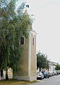
Category:Bell tower Pamhagen
Jump to navigation
Jump to search
| Object location | | View all coordinates using: OpenStreetMap |
|---|
 | |||||
| Upload media | |||||
| Instance of | |||||
|---|---|---|---|---|---|
| Location | Pamhagen, Neusiedl am See District, Burgenland, Austria | ||||
| Heritage designation | |||||
 | |||||
Deutsch: Türkenturm, Glockenturm Pamhagen
Media in category "Bell tower Pamhagen"
The following 8 files are in this category, out of 8 total.
-
 GuentherZ 2012-08-11 3692 Pamhagen Glockenturm Tuerkenturm.jpg 1,318 × 1,800; 1.14 MB
-
 GuentherZ 2012-08-11 3693 Pamhagen Glockenturm Tuerkenturm Tafel.jpg 1,440 × 1,800; 1.24 MB
-
 GuentherZ 2012-08-11 3694 Pamhagen Glockenturm Tuerkenturm Turmspitze.jpg 1,254 × 1,800; 917 KB
-
 GuentherZ 2012-08-11 3698 Pamhagen Glockenturm Tuerkenturm.jpg 1,276 × 1,800; 1.31 MB
-
 Pamh.Glockenturm-Innen.png 1,000 × 750; 1.19 MB
-
 Pamh.Glockenturm-Innen2.png 750 × 1,000; 1.11 MB
-
 Pamh.Glockenturm.png 750 × 1,000; 761 KB
-
 Pamh.Glockenturm2.png 750 × 1,000; 658 KB


