Category:Church of the Visitation (Maria Ach)
Jump to navigation
Jump to search
| Object location | | View all coordinates using: OpenStreetMap |
|---|
church building in Hochburg-Ach, Austria .jpg) _02.jpg) | |||||
| Upload media | |||||
| Instance of | |||||
|---|---|---|---|---|---|
| Named after | |||||
| Location | Hochburg-Ach, Braunau District, Upper Austria, Austria | ||||
| Street address |
| ||||
| Heritage designation | |||||
 | |||||
Media in category "Church of the Visitation (Maria Ach)"
The following 28 files are in this category, out of 28 total.
-
 Church of the Visitation (Maria Ach) 01.jpg 2,092 × 2,602; 1.72 MB
-
 Church of the Visitation (Maria Ach) 02.jpg 3,984 × 2,656; 2.22 MB
-
 Church of the Visitation (Maria Ach) 03.jpg 3,008 × 2,656; 1.95 MB
-
 Church of the Visitation (Maria Ach) 04.jpg 3,424 × 2,467; 2.12 MB
-
 Church of the Visitation (Maria Ach) 05.jpg 2,423 × 2,656; 1.61 MB
-
 Church of the Visitation (Maria Ach) 06.jpg 2,492 × 2,248; 1.26 MB
-
 Church of the Visitation (Maria Ach) 07.jpg 2,656 × 3,984; 2.9 MB
-
 Church of the Visitation (Maria Ach) 08.jpg 3,984 × 2,656; 1.49 MB
-
 Church of the Visitation (Maria Ach) 09.jpg 2,656 × 3,984; 2.62 MB
-
 Maria Ach (Gemeinde Hochburg-Ach) 01.jpg 2,673 × 2,000; 3.82 MB
-
 Maria Ach (Gemeinde Hochburg-Ach) 02.jpg 3,008 × 2,000; 4.07 MB
-
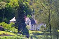
 Maria Ach (Wanghausen).jpg 5,184 × 3,456; 2.79 MB
-
 Maria Ach, 3.jpeg 2,800 × 2,100; 1.46 MB
-
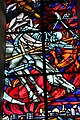
 Maria Ach, Glasfenster, 1.jpeg 1,800 × 2,400; 1.14 MB
-
 Maria Ach, Ostseite, 1.jpeg 2,240 × 2,240; 1.14 MB
-
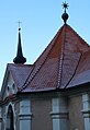
 Maria Ach, Südseite, 1.jpeg 3,200 × 2,128; 1.31 MB
-
 Maria Ach, Turm, 1.jpeg 1,600 × 3,200; 1.88 MB
-
 Maria Ach.JPG 3,008 × 2,000; 4.18 MB
-
 Pfarrkirche Maria Ach 01.jpg 3,984 × 2,656; 2.94 MB
-
 Pfarrkirche Maria Ach 02.jpg 2,656 × 3,984; 2.77 MB
-
 Pfarrkirche Maria Ach 03.jpg 2,658 × 2,556; 1.53 MB
-
 Pfarrkirche Maria Ach 04.jpg 3,984 × 2,656; 2.88 MB
-
 Pfarrkirche Maria Ach 05.jpg 3,984 × 2,656; 2.53 MB
-
 Pfarrkirche Maria Ach 06.jpg 3,854 × 2,559; 1.83 MB
-
 Pfarrkirche Maria Ach 07.jpg 2,656 × 3,984; 2.17 MB
-
 Pfarrkirche Maria Ach 08.jpg 2,046 × 2,853; 2.06 MB
-
 Pfarrkirche Maria Ach 09.jpg 2,223 × 2,655; 2.54 MB
-
 Pfarrkirche Maria Ach 10.jpg 2,549 × 3,702; 1.38 MB
_01.jpg)
_03.jpg)
_04.jpg)
_05.jpg)
_06.jpg)
_07.jpg)
_08.jpg)
_09.jpg)
_01.jpg)
_02.jpg)


