Category:Im Klosterhof Nr 4, Kennelbach Vbg, Aufbahrungshalle
Jump to navigation
Jump to search
| Object location | | View all coordinates using: OpenStreetMap |
|---|
 | |||||
| Upload media | |||||
| Instance of | |||||
|---|---|---|---|---|---|
| Part of | |||||
| Location | Kennelbach, Bregenz District, Vorarlberg, Austria | ||||
| Street address |
| ||||
| Heritage designation | |||||
 | |||||
Media in category "Im Klosterhof Nr 4, Kennelbach Vbg, Aufbahrungshalle"
The following 6 files are in this category, out of 6 total.
-
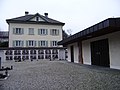 Im Klosterhof Nr 4, Kennelbach Vbg, Aufbahrungshalle mit Pfarrhof im Hintergrund.JPG 3,072 × 2,304; 1.7 MB
-
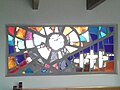 Kennelbach Vbg, Aufbahrungshalle Glasfenster.jpg 2,560 × 1,920; 1.03 MB
-
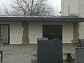 Kennelbach Vbg, Aufbahrungshalle m 2 Heiligenreliefs v Emmerich Kerle frontal.jpg 2,560 × 1,920; 1.47 MB
-
 Kennelbach Vbg, Aufbahrungshalle m 2 Heiligenreliefs v Emmerich Kerle seitl.jpg 1,920 × 2,560; 2.35 MB
-
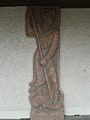 Kennelbach Vbg, Aufbahrungshalle, Hl Georg der Drachentöter, Emmerich Kerle 1974.jpg 1,920 × 2,560; 2.03 MB
-
 Kennelbach Vbg, Signatur Emmerich Kerle auf Heiligenrelief Der verlorene Sohn 1974.jpg 1,920 × 2,560; 2.71 MB


