Category:Kaplanstöckl Gaspoltshofen
Jump to navigation
Jump to search
| Object location | | View all coordinates using: OpenStreetMap |
|---|
.jpg) | |||||
| Upload media | |||||
| Instance of | |||||
|---|---|---|---|---|---|
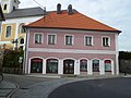
| Location | Gaspoltshofen, Grieskirchen District, Upper Austria, Austria | ||||
| Street address |
| ||||
| Heritage designation | |||||
 | |||||
Deutsch: Kaplanstöckl Gaspoltshofen
Media in category "Kaplanstöckl Gaspoltshofen"
The following 3 files are in this category, out of 3 total.
-
 Gaspoltshofen (Kaplanstöckl-1).jpg 2,048 × 1,536; 428 KB
-
 Gaspoltshofen (Kaplanstöckl-2).jpg 2,048 × 1,536; 395 KB
-

.jpg)
