Category:Wallfahrtskirche Maria Bründl
Jump to navigation
Jump to search
| Object location | | View all coordinates using: OpenStreetMap |
|---|
| This category shows the protected monument with the number 14842 in Austria. (Commons, de, Wikidata) |
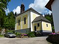
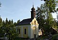
church building in Putzleinsdorf, Austria  | |||||
| Upload media | |||||
| Instance of | |||||
|---|---|---|---|---|---|
| Location | Putzleinsdorf, Rohrbach District, Upper Austria, Austria | ||||
| Street address |
| ||||
| Heritage designation | |||||
 | |||||
Subcategories
This category has only the following subcategory.
I
Media in category "Wallfahrtskirche Maria Bründl"
The following 6 files are in this category, out of 6 total.
-
 Maria Bründl - Außen.jpg 4,000 × 3,000; 2.95 MB
-
 Maria Bründl - Blick auf die Kapelle 1.jpg 3,000 × 4,000; 4.59 MB
-
 Maria Bründl - Blick auf die Kapelle 2.jpg 4,000 × 3,000; 4.26 MB
-
 Wallfahrtskirche Maria Bründl Außen I.jpg 2,808 × 1,972; 4.04 MB
-
 Wallfahrtskirche Maria Bründl Außen II.jpg 1,806 × 2,922; 4.34 MB
-
 Wallfahrtskirche Maria Bründl Außen III.jpg 1,648 × 2,940; 2.9 MB


