Category:Wohnhausanlage Mexikoplatz 2-3
Jump to navigation
Jump to search
Deutsch: Wohnhausanlage Mexikoplatz 2-3

| Object location | | View all coordinates using: OpenStreetMap |
|---|
public housing in Leopoldstadt  | |||||
| Upload media | |||||
| Instance of | |||||
|---|---|---|---|---|---|
| Location |
| ||||
| Street address |
| ||||
| Architect |
| ||||
| Inception |
| ||||
 | |||||
Media in category "Wohnhausanlage Mexikoplatz 2-3"
The following 4 files are in this category, out of 4 total.
-
 Dsc (263274631).jpeg 2,048 × 1,367; 795 KB
-
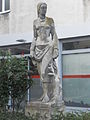 Gaertnerinpomona.JPG 3,000 × 4,000; 2.86 MB
-
 Gärtnerin von Ernst Wenzelis.jpg 4,000 × 6,000; 6.29 MB
-
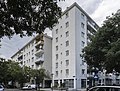 Wohnhausanlage Mexikoplatz 2-3.jpg 4,970 × 3,752; 4.03 MB
.jpeg)

