Datei:Map of Arizona highlighting Yuma County.svg
Zur Navigation springen
Zur Suche springen

Größe der PNG-Vorschau dieser SVG-Datei: 487 × 599 Pixel. Weitere aus SVG automatisch erzeugte PNG-Grafiken in verschiedenen Auflösungen: 195 × 240 Pixel | 390 × 480 Pixel | 624 × 768 Pixel | 832 × 1.024 Pixel | 1.664 × 2.048 Pixel | 893 × 1.099 Pixel
Originaldatei (SVG-Datei, Basisgröße: 893 × 1.099 Pixel, Dateigröße: 260 KB)
![]()
Diese Datei und die Informationen unter dem roten Trennstrich werden aus dem zentralen Medienarchiv Wikimedia Commons eingebunden.
![]()
Beschreibung
| Beschreibung |
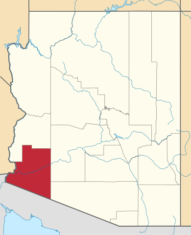
English: Locator map of Yuma County in Arizona. |
||
| Datum | |||
| Quelle | v.1: David Benbennick; v.2: File:USA Arizona location map.svg | ||
| Urheber | Eigenes Werk. | ||
| Genehmigung (Weiternutzung dieser Datei) |
|
||
| Andere Versionen | |||
| Commons images used |
- For more information, see Commons:United States county locator maps.
Dateiversionen
Klicke auf einen Zeitpunkt, um diese Version zu laden.
| Version vom | Vorschaubild | Maße | Benutzer | Kommentar | |
|---|---|---|---|---|---|
| aktuell | 00:09, 1. Mär. 2015 | | 893 × 1.099 (260 KB) | Sumiaz | Newer version based on File:USA Arizona location map.svg |
| 12:08, 12. Feb. 2006 |  | 5.453 × 6.322 (56 KB) | David Benbennick | {{subst:User:Dbenbenn/clm|county=Yuma County|state=Arizona}} |
Dateiverwendung
Die folgenden 11 Seiten verwenden diese Datei:
Globale Dateiverwendung
Die nachfolgenden anderen Wikis verwenden diese Datei:
- Verwendung auf ar.wikipedia.org
- Verwendung auf be.wikipedia.org
- Verwendung auf bg.wikipedia.org
- Verwendung auf bpy.wikipedia.org
- Verwendung auf ca.wikipedia.org
- Verwendung auf cdo.wikipedia.org
- Verwendung auf ceb.wikipedia.org
- Verwendung auf ce.wikipedia.org
- Verwendung auf cs.wikipedia.org
- Verwendung auf cy.wikipedia.org
- Verwendung auf da.wikipedia.org
- Verwendung auf en.wikipedia.org
- List of counties in Arizona
- Yuma County, Arizona
- Fortuna Foothills, Arizona
- Gadsden, Arizona
- Somerton, Arizona
- Tacna, Arizona
- Wellton, Arizona
- Yuma, Arizona
- Yuma Proving Ground
- San Luis, Arizona
- Template:Yuma County, Arizona
- Cocopah Indian Reservation
- Fort Yuma Indian Reservation
- Mohawk, Arizona
- Dateland, Arizona
- Roll, Arizona
- User:Nyttend/County templates/AZ
- Castle Dome Mountains
- Castle Dome Landing, Arizona
- National Register of Historic Places listings in Yuma County, Arizona
- Category:Populated places in Yuma County, Arizona
Weitere globale Verwendungen dieser Datei anschauen.