Category:Annenturm, Althofen
Jump to navigation
Jump to search
| This category shows the protected monument with the number 34155 in Austria. (Commons, de, Wikidata) |
| Object location | | View all coordinates using: OpenStreetMap |
|---|
| Object location | | View all coordinates using: OpenStreetMap |
|---|
 | |||||
| Upload media | |||||
| Instance of | |||||
|---|---|---|---|---|---|
| Location | Althofen, Sankt Veit an der Glan District, Carinthia, Austria | ||||
| Street address |
| ||||
| Heritage designation | |||||
 | |||||
Media in category "Annenturm, Althofen"
The following 10 files are in this category, out of 10 total.
-

-

-
 Althofen Grobeckerplatz 1 Annenturm 24062015 5296.jpg 7,360 × 4,912; 15.59 MB
-
 Althofen Grobeckerplatz 1 Annenturm SO-Ansicht 20082018 6186.jpg 3,241 × 4,869; 12.72 MB
-
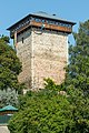
 Althofen - Annenturm.jpg 2,790 × 3,134; 2 MB
-
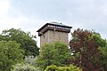
 Althofen - Annenturm2.jpg 3,550 × 2,909; 2.61 MB
-
 Althofen - Annenturm3.JPG 5,184 × 3,456; 7.04 MB
-
 Althofen Altstadt Turm 21092007 47.jpg 2,592 × 3,872; 1.6 MB
-
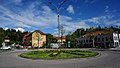 Althofen-Kreisverkehr.jpg 1,500 × 847; 754 KB
-
 Altstadt mit schneebedeckter Grebenzen im Hintergrund.JPG 3,986 × 1,858; 1.44 MB


