Category:Bruneiteich (Altmanns)
Jump to navigation
Jump to search

| Object location | | View all coordinates using: OpenStreetMap |
|---|
_2014-05_02.jpg) | |||||
| Upload media | |||||
| Instance of | |||||
|---|---|---|---|---|---|
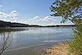
| Location | Heidenreichstein, Gmünd District, Lower Austria, Austria | ||||
 | |||||
Media in category "Bruneiteich (Altmanns)"
The following 3 files are in this category, out of 3 total.
-
 Bruneiteich bei Altmanns (Heidenreichstein) 2014-05 01.jpg 4,500 × 3,000; 4.84 MB
-
 Bruneiteich bei Altmanns (Heidenreichstein) 2014-05 02.jpg 4,500 × 3,000; 4.85 MB
-
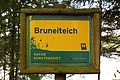 Naturschutzgebiet Bruneiteich - Schild.jpg 4,500 × 3,000; 4.45 MB
_2014-05_01.jpg)
