Category:Church of St. Georgen am Steinfelde
Jump to navigation
Jump to search
| Object location | | View all coordinates using: OpenStreetMap |
|---|
church building in Lower Austria, Austria  | |||||
| Upload media | |||||
| Instance of | |||||
|---|---|---|---|---|---|
| Named after | |||||
| Location | St. Pölten, Lower Austria, Austria | ||||
| Street address |
| ||||
| Heritage designation | |||||
 | |||||
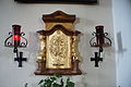
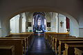
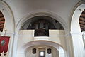
Media in category "Church of St. Georgen am Steinfelde"
The following 41 files are in this category, out of 41 total.
-
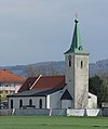
 Kirche St. Georgen.JPG 3,872 × 2,592; 3.48 MB
-
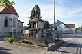 Kriegerdenkmal St. Georgen 5.JPG 4,592 × 3,056; 5.81 MB
-
 Pfarrkirche St. Georgen am Steinfelde - 001.JPG 4,592 × 3,056; 4.69 MB
-
 Pfarrkirche St. Georgen am Steinfelde - 002.JPG 3,056 × 4,592; 4.35 MB
-
 Pfarrkirche St. Georgen am Steinfelde - 003.JPG 3,056 × 4,592; 4.33 MB
-
 Pfarrkirche St. Georgen am Steinfelde - 004.JPG 4,592 × 3,056; 5.38 MB
-
 Pfarrkirche St. Georgen am Steinfelde - 005.JPG 3,056 × 4,592; 3.95 MB
-
 Pfarrkirche St. Georgen am Steinfelde - 006.JPG 3,056 × 4,592; 3.26 MB
-
 Pfarrkirche St. Georgen am Steinfelde - 007.JPG 3,056 × 4,592; 3.93 MB
-
 Pfarrkirche St. Georgen am Steinfelde - 008.JPG 4,592 × 3,056; 5.09 MB
-
 Pfarrkirche St. Georgen am Steinfelde - 009.JPG 3,056 × 4,592; 3.9 MB
-
 Pfarrkirche St. Georgen am Steinfelde - 010.JPG 4,592 × 3,056; 3.81 MB
-
 Pfarrkirche St. Georgen am Steinfelde - 011.JPG 4,592 × 3,056; 4.03 MB
-
 Pfarrkirche St. Georgen am Steinfelde - 012.JPG 4,592 × 3,056; 4.06 MB
-
 Pfarrkirche St. Georgen am Steinfelde - 013.JPG 3,056 × 4,592; 2.99 MB
-
 Pfarrkirche St. Georgen am Steinfelde - 014.JPG 3,056 × 4,592; 4.35 MB
-
 Pfarrkirche St. Georgen am Steinfelde - 015.JPG 3,056 × 4,592; 3.82 MB
-
 Pfarrkirche St. Georgen am Steinfelde - 016.JPG 3,056 × 4,592; 3.68 MB
-
 Pfarrkirche St. Georgen am Steinfelde - 017.JPG 3,056 × 4,592; 3.41 MB
-
 Pfarrkirche St. Georgen am Steinfelde - 018.JPG 3,056 × 4,592; 3.59 MB
-
 Pfarrkirche St. Georgen am Steinfelde - 019.JPG 4,592 × 3,056; 4.28 MB
-
 Pfarrkirche St. Georgen am Steinfelde - 020.JPG 3,056 × 4,592; 3.28 MB
-
 Pfarrkirche St. Georgen am Steinfelde - 021.JPG 3,056 × 4,592; 3.11 MB
-
 Pfarrkirche St. Georgen am Steinfelde - 022.JPG 4,592 × 3,056; 4.63 MB
-
 Pfarrkirche St. Georgen am Steinfelde - 023.JPG 3,056 × 4,592; 3.48 MB
-
 Pfarrkirche St. Georgen am Steinfelde - 024.JPG 3,056 × 4,592; 2.8 MB
-
 Pfarrkirche St. Georgen am Steinfelde - 025.JPG 4,592 × 3,056; 5.13 MB
-
 Pfarrkirche St. Georgen am Steinfelde - 026.JPG 4,592 × 3,056; 5.53 MB
-
 Pfarrkirche St. Georgen am Steinfelde - 027.JPG 4,592 × 3,056; 5.5 MB
-
 Pfarrkirche St. Georgen am Steinfelde - 028.JPG 3,056 × 4,592; 4.1 MB
-
 Pfarrkirche St. Georgen am Steinfelde - 029.JPG 3,056 × 4,592; 3.55 MB
-
 Pfarrkirche St. Georgen am Steinfelde - 030.JPG 3,056 × 4,592; 4.82 MB
-
 Pfarrkirche St. Georgen am Steinfelde - 031.JPG 3,056 × 4,592; 4.48 MB
-
 Pfarrkirche St. Georgen am Steinfelde - 032.JPG 4,592 × 3,056; 5.53 MB
-
 Pfarrkirche St. Georgen am Steinfelde - 033.JPG 3,056 × 4,592; 4.96 MB
-
 Pfarrkirche St. Georgen am Steinfelde - 034.JPG 3,056 × 4,592; 3.95 MB
-
 Pfarrkirche St. Georgen am Steinfelde - 035.JPG 3,056 × 4,592; 4.02 MB
-
 Pfarrkirche St. Georgen am Steinfelde - 036.JPG 4,592 × 3,056; 4.56 MB
-
 Pfarrkirche St. Georgen am Steinfelde.jpg 3,449 × 4,120; 9.09 MB
-
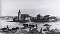 St.Georgen 1828.jpg 2,498 × 1,417; 1.26 MB
-
 St.Georgen Kirche 1758 Aquilin Hacker.jpg 1,306 × 952; 437 KB


