Category:Church of the Visitation (Oberkreuzstetten)
Jump to navigation
Jump to search
| Object location | | View all coordinates using: OpenStreetMap |
|---|
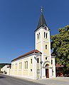
church building in Kreuzstetten, Austria   | |||||
| Upload media | |||||
| Instance of | |||||
|---|---|---|---|---|---|
| Named after | |||||
| Location | Kreuzstetten, Mistelbach District, Lower Austria, Austria | ||||
| Heritage designation | |||||
 | |||||
Media in category "Church of the Visitation (Oberkreuzstetten)"
The following 19 files are in this category, out of 19 total.
-
 Kirche 1836 Buntglasfenster in A-2124 Oberkreuzstetten (01).jpg 1,810 × 4,593; 2.02 MB
-
 Kirche 1836 Buntglasfenster in A-2124 Oberkreuzstetten (02).jpg 1,810 × 4,600; 1.82 MB
-
 Kirche 1836 Buntglasfenster in A-2124 Oberkreuzstetten (03).jpg 1,810 × 4,600; 1.78 MB
-
 Kirche 1836 Buntglasfenster in A-2124 Oberkreuzstetten (04).jpg 1,810 × 4,600; 1.83 MB
-
 Kirche 1836 Buntglasfenster in A-2124 Oberkreuzstetten (05).jpg 1,810 × 4,600; 1.78 MB
-
 Kirche 1836 Buntglasfenster in A-2124 Oberkreuzstetten (06).jpg 1,810 × 4,600; 1.77 MB
-
 Kirche 1836 Buntglasfenster in A-2124 Oberkreuzstetten (07).jpg 1,810 × 4,600; 1.89 MB
-
 Kirche 1836 Buntglasfenster in A-2124 Oberkreuzstetten (08).jpg 1,810 × 4,600; 1.92 MB
-
 Kirche 1836 Buntglasfenster in A-2124 Oberkreuzstetten (09).jpg 1,810 × 4,600; 1.85 MB
-
 Kirche 1836 Buntglasfenster in A-2124 Oberkreuzstetten (10).jpg 1,810 × 4,600; 1.59 MB
-
 Kirche 1836 Buntglasfenster in A-2124 Oberkreuzstetten (11).jpg 1,810 × 4,600; 1.8 MB
-
 Kirche 1836 Buntglasfenster in A-2124 Oberkreuzstetten (12).jpg 1,810 × 4,600; 1.79 MB
-
 Kirche 1836 Buntglasfenster in A-2124 Oberkreuzstetten (13).jpg 1,810 × 4,600; 1.89 MB
-
 Kirche 1836 Buntglasfenster in A-2124 Oberkreuzstetten (14).jpg 2,286 × 2,602; 1.59 MB
-
 Kirche 1836 Hauptaltar in A-2124 Oberkreuzstetten.jpg 3,835 × 4,578; 2.16 MB
-
 Kirche 1836 in A-2124 Oberkreuzstetten.jpg 3,806 × 4,708; 2.58 MB
-
 Kirche 1836 Presbyterium in A-2124 Oberkreuzstetten.jpg 6,016 × 4,016; 3.94 MB
-
 NOE Oberkreuzstetten Pfarrkirche.jpg 2,776 × 2,024; 2.71 MB
-
 Oberkreuzstetten katholische Pfarrkirche Mariae Heimsuchung.jpg 1,024 × 747; 381 KB
.jpg)


.jpg)
.jpg)
.jpg)
.jpg)
.jpg)
.jpg)
.jpg)
.jpg)
.jpg)
.jpg)
.jpg)
.jpg)
.jpg)