Category:Hall in Tirol Basispunkt der Landvermessung
Jump to navigation
Jump to search
 | |||||
| Upload media | |||||
| Instance of | |||||
|---|---|---|---|---|---|
| Location | Hall in Tirol, Innsbruck-Land District, Tyrol, Austria | ||||
| Street address |
| ||||
| Heritage designation | |||||
 | |||||
Hall in Tirol Basispunkt der Landvermessung
| This category shows the protected monument with the number 116547 in Austria. (Commons, de, Wikidata) |
|
This category shows the remarkable cultural object in the Austrian state of Tyrol listed by the Tyrolean Art Cadastre with the ID
70138. (on tirisMaps, pdf, more images on Commons, Wikidata) |
Media in category "Hall in Tirol Basispunkt der Landvermessung"
The following 3 files are in this category, out of 3 total.
-
 Basispunkt der Landvermessung Rückseite.JPG 1,200 × 1,600; 1 MB
-
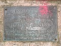 Basispunkt der Landvermessung Schild.JPG 1,600 × 1,200; 695 KB
-
 Basispunkt der Landvermessung.jpg 803 × 1,441; 566 KB

