Category:Kapelle Jakobbauer Unterfresen
Jump to navigation
Jump to search
| Object location | | View all coordinates using: OpenStreetMap |
|---|
 | |||||
| Upload media | |||||
| Instance of | |||||
|---|---|---|---|---|---|
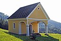
| Location | Wies, Deutschlandsberg District, Styria, Austria | ||||
| Street address |
| ||||
| Heritage designation | |||||
 | |||||
Media in category "Kapelle Jakobbauer Unterfresen"
The following 4 files are in this category, out of 4 total.
-
 Kapelle Jokabauer Unterfresen Nordseite.jpg 2,896 × 1,944; 4.39 MB
-
 Kapelle Jokabauer Unterfresen Südwand.jpg 2,896 × 1,944; 3.35 MB
-
 Kapelle Jokabauer Unterfresen.jpg 2,896 × 1,944; 3.15 MB
-
 Kapelle und Stöckl beim Hof vlg Jokabauer Unterfresen.jpg 2,896 × 1,944; 4.4 MB


