Category:Karner Maria Saal
Jump to navigation
Jump to search
| Object location | | View all coordinates using: OpenStreetMap |
|---|
 | |||||
| Upload media | |||||
| Instance of | |||||
|---|---|---|---|---|---|
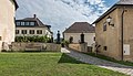
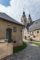
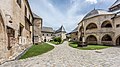
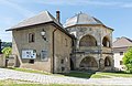
| Location | Maria Saal, Klagenfurt-Land District, Carinthia, Austria | ||||
| Street address |
| ||||
| Heritage designation | |||||
 | |||||
| This category shows the protected monument with the number 12901 in Austria. (Commons, de, Wikidata) |
Subcategories
This category has only the following subcategory.
Media in category "Karner Maria Saal"
The following 64 files are in this category, out of 64 total.
-
 Fresko Karner Maria Saal.JPG 4,000 × 3,000; 4.7 MB
-
 Hl Grab Karner Maria Saal.JPG 4,000 × 3,000; 4.28 MB
-
 Maria Saal Am Platzl 6 Karner Wappengrabstein Hanns Pruggmayr 27022015 0084.jpg 7,061 × 4,874; 17.11 MB
-

-
 Maria Saal Collegiatsstift Wehranlage mit Dom SO-Ansicht 27022015 0119.jpg 7,334 × 4,857; 20.51 MB
-
 Maria Saal Domplatz 6 Kanonikerstöckl Karner Aufbahrungshalle Lichtsäule 30062017 0065.jpg 7,003 × 4,743; 17.21 MB
-

-

-
-
 Maria Saal Domplatz 6 Kanonikerstöckl und Karner Teilansicht 22032018 2758.jpg 7,360 × 4,912; 25.27 MB
-
 Maria Saal Domplatz 6 Kanonikerstöckl und Karner Teilansicht 22032018 2759.jpg 7,360 × 4,912; 25.01 MB
-
 Maria Saal Domplatz 6 Karner 06012014 535.jpg 4,928 × 3,264; 9.8 MB
-
 Maria Saal Domplatz 6 Karner 11012017 5976.jpg 7,360 × 4,912; 22.37 MB
-
 Maria Saal Domplatz 6 Karner Eingang mit Epitaphien der Fam. Möderndorfer 30062017 0039.jpg 7,360 × 4,912; 17.57 MB
-
 Maria Saal Domplatz 6 Karner Heiliges Grab 13052022 2581.jpg 7,360 × 4,912; 22.75 MB
-
 Maria Saal Domplatz 6 Karner Ost-Ansicht 19102023 0087.jpg 3,280 × 4,928; 10.68 MB
-
 Maria Saal Domplatz 6 Karner Ost-Ansicht 22032018 2749.jpg 7,238 × 4,117; 18.09 MB
-
 Maria Saal Domplatz 6 Karner Umgang 22032018 2760.jpg 7,360 × 4,912; 21.91 MB
-
 Maria Saal Domplatz 6 Karner und Lichtsäule 06012014 552.jpg 4,928 × 3,264; 9.53 MB
-
 Maria Saal Domplatz 6 Karner und Lichtsäule 22032018 2766.jpg 5,725 × 3,757; 11.44 MB
-
 Maria Saal Domplatz 6 Karner und Lichtsäule 30062017 0045.jpg 7,297 × 4,084; 17.46 MB
-
 Maria Saal Domplatz 6 Karner Wandbild von 1521 Beweinung Christi 03072017 0069.jpg 7,360 × 4,912; 35.09 MB
-
 Maria Saal Domplatz 6 Karner Wandbild von 1521 Grablegung Christi 03072017 0070.jpg 7,360 × 4,912; 26.76 MB
-
 Maria Saal Domplatz 6 Karner Wandbild von 1521 Kreuzabnahme 03072017 0068.jpg 7,360 × 4,912; 28.57 MB
-
 Maria Saal Domplatz 6 Karner Wandbild von 1521 Kreuzigung 03072017 0067.jpg 7,360 × 4,912; 27.65 MB
-
 Maria Saal Domplatz 6 Kollegiatstift Einfahrt am Kanonikerstöckl 28082022 2915.jpg 7,360 × 4,260; 17.14 MB
-
 Maria Saal Domplatz 6 Kollegiatstift Einfahrt am Kanonikerstöckl 28082022 2918.jpg 4,579 × 6,848; 16.49 MB
-
 Maria Saal Domplatz 6 Lichtsaeule und Heidentempel 15092011 855.jpg 3,112 × 2,040; 1.86 MB
-
 Maria Saal Domplatz 7 Mesnerhaus 15092011 844.jpg 4,256 × 2,832; 3.78 MB
-
 Maria Saal Domplatz 7 Mesnerhaus und Domshop-Café NW-Ansicht 31102018 5267.jpg 7,360 × 4,912; 20.91 MB
-
 Maria Saal Domplatz Aufbahrungshalle N-Ansicht 30092016 4642.jpg 2,595 × 4,165; 5.4 MB
-
 Maria Saal Domplatz Dom Kapitelhaus Karner und Lichtsaeule 30062017 0046.jpg 7,212 × 4,049; 18.03 MB
-
 Maria Saal Domplatz Kanonikerstoeckl Heidentempel Lichtsaeule Aufbahrungshalle 30092016 4676.jpg 7,065 × 4,424; 14.74 MB
-
 Maria Saal Domplatz Kanonikerstoeckl und Heidentempel 28052015 4200.jpg 6,935 × 4,504; 17.13 MB
-
 Maria Saal Domplatz Kapitelhaus Lichtsäule und Karner 19102023 0101.jpg 4,928 × 3,280; 9.33 MB
-
 Maria Saal Domplatz Kapitelhaus mit Torbau Lichtsäule und Karner 22032018 2770.jpg 7,310 × 4,386; 16.71 MB
-
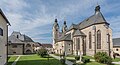
 Maria Saal Domplatz Wallfahrtskirche Mariä Himmelfahrt 28082022 2916.jpg 6,188 × 4,574; 15.56 MB
-
 Maria Saal Domplatz Wallfahrtskirche Mariä Himmelfahrt SO-Ansicht 28082022 2921.jpg 6,096 × 4,305; 13.92 MB
-
 Maria Saal Kollegiatstift Domplatz Kanonikerstoeckl Eingang 26092016 4496.jpg 3,280 × 4,928; 10.67 MB
-
 Maria Saal Kollegiatstift ehem Wehrgraben an der Dechantei 19092016 4387.jpg 6,192 × 4,657; 15.8 MB
-
 Maria Saal Kollegiatstift ehem Wehrgraben an der Dechantei 19092016 4389.jpg 4,676 × 6,695; 17.3 MB
-
 Maria Saal Kollegiatstift ehem Wehrgraben an der Dechantei 22032018 2772.jpg 7,158 × 4,912; 23.82 MB
-
 Maria Saal Kollegiatstift Kanonikerstöckl und Karner Ost-Ansicht 28092016 4582.jpg 7,013 × 4,027; 16.3 MB
-
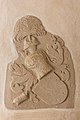
 Maria Saal Kollegiatstift Karner Steinrelief 01032017 4828.jpg 3,269 × 4,240; 10.09 MB
-
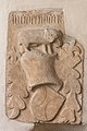
 Maria Saal Kollegiatstift Karner Wappenstein der Moederndorfer 01032017 4825.jpg 3,193 × 4,538; 10.68 MB
-
 Maria Saal Kollegiatstift Karner Wappenstein der Moederndorfer 01032017 4829.jpg 3,171 × 4,566; 10.78 MB
-
 Maria Saal Kollegiatstift Karner Wappenstein der Moederndorfer 19092016 4398.jpg 4,912 × 7,360; 20.86 MB
-
 Maria Saal Kollegiatstift Karner Wappenstein der Moederndorfer 19092016 4399.jpg 4,912 × 7,360; 23.77 MB
-
 Maria Saal Kollegiatstift Sued-Einfahrt 28092016 4576.jpg 7,360 × 4,912; 22.7 MB
-
 Maria Saal Pfarr-und Wallfahrtskirche Mariä Himmelfahrt SO-Ansicht 28092016 4587.jpg 7,165 × 3,871; 14.7 MB
-
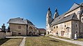 Maria Saal Pfarr-und Wallfahrtskirche Mariä Himmelfahrt und Karner 22032018 2742.jpg 6,995 × 3,922; 15.98 MB
-
 Maria Saal Pfarr-und Wallfahrtskirche Mariä Himmelfahrt und Karner 22032018 2743.jpg 6,510 × 3,723; 12.47 MB
-
 Maria Saal Propstei Wallfahrtskirche 27052008 66.jpg 2,464 × 1,632; 822 KB
-
 Maria Saal Wallfahrtskirche Mariä Himmelfahrt Querhaus S-Wand 03072017 0076.jpg 6,621 × 4,664; 23.64 MB
-
 Maria Saal Gotische Lichtsaeule Karner 17102006 01.jpg 2,292 × 2,676; 692 KB
-
 Maria Saal Karner Fresko Grablegung 01.jpg 5,836 × 3,891; 16.6 MB
-
 Maria Saal Karner Fresko Kreuzigung 01.jpg 5,616 × 3,744; 15.7 MB
-
 Maria Saal Lichtsäule Kapitelhaus Karner 20170526.jpg 5,761 × 3,841; 11.74 MB
-
 Maria Saal Lichtsäule und Karner 20170526 01.jpg 5,504 × 3,669; 9.64 MB
-
 Maria Saal Lichtsäule und Karner 20170526 02.jpg 3,832 × 5,748; 11.52 MB
-
 Maria-Saal-am-Domplatz3.jpg 1,529 × 1,168; 1.1 MB
-
 Tor bei Karner Maria Saal.JPG 3,000 × 4,000; 4.23 MB
-
 Umgang Karner Maria Saal.JPG 3,000 × 4,000; 4.35 MB
-
 Wappen Möderndorfer Karner Maria Saal.JPG 3,000 × 4,000; 4.04 MB


