Category:Kriegerdenkmal Graz Radetzkystraße
Jump to navigation
Jump to search
| Object location | | View all coordinates using: OpenStreetMap |
|---|
 | |||||
| Upload media | |||||
| Instance of | |||||
|---|---|---|---|---|---|
| Location | Graz, Styria, Austria | ||||
| Street address |
| ||||
| Heritage designation | |||||
 | |||||
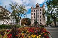
Deutsch: Kriegerdenkmal, bei Radetzkystraße 10, Graz
Media in category "Kriegerdenkmal Graz Radetzkystraße"
The following 2 files are in this category, out of 2 total.
-
 Graz Kriegerdenkmal bei Radetzkystraße 10.jpg 635 × 1,024; 183 KB
-
 17-09-07-Wikidaheim-Graz RR70441.jpg 4,288 × 2,848; 8.37 MB
