Category:Maria am grünen Anger, Anger
Jump to navigation
Jump to search
| Object location | | View all coordinates using: OpenStreetMap |
|---|
 | |||||
| Upload media | |||||
| Instance of | |||||
|---|---|---|---|---|---|
| Location | Anger, Weiz District, Styria, Austria | ||||
| Street address |
| ||||
| Heritage designation | |||||
 | |||||
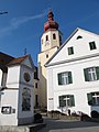
English: Wayside shrine Maria am grünen Anger, at Anger bei Weiz
Deutsch: Bildstock Maria am grünen Anger, in Anger bei Weiz
Media in category "Maria am grünen Anger, Anger"
The following 5 files are in this category, out of 5 total.
-
 Anger bei Weiz Kapelle.JPG 1,527 × 2,291; 1.91 MB
-
 Bildstock Kirchplatz Anger.JPG 2,736 × 3,648; 1.96 MB
-
 Maria am grünen Anger.jpg 2,816 × 4,374; 4.48 MB
-
 Pfarrhof anger steiermark.JPG 3,648 × 2,736; 2.25 MB
-
 Pfarrkirche Anger.JPG 3,648 × 2,736; 1.79 MB


