Category:Palluahaus, Innsbruck
Jump to navigation
Jump to search
| Object location | | View all coordinates using: OpenStreetMap |
|---|
building in Innsbruck, Austria  | |||||
| Upload media | |||||
| Instance of | |||||
|---|---|---|---|---|---|
| Location | Innsbruck, Tyrol, Austria | ||||
| Street address |
| ||||
| Heritage designation | |||||
 | |||||
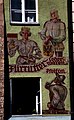
Deutsch: Innsbruck-Herzog-Friedrichstr 12: Palluahaus
| This category shows the protected monument with the number 39102 in Austria. (Commons, de, Wikidata) |
|
This category shows the remarkable cultural object in the Austrian state of Tyrol listed by the Tyrolean Art Cadastre with the ID
83592. (on tirisMaps, pdf, more images on Commons, Wikidata) |
Media in category "Palluahaus, Innsbruck"
The following 10 files are in this category, out of 10 total.
-
 12-06-05-innsbruck-by-ralfr-103.jpg 2,136 × 3,216; 2.97 MB
-
 Ansitz Neuhof, Goldenes Dachl 4.jpg 2,000 × 1,195; 2.61 MB
-
 Austria 1993 - Innsbruck.jpg 4,182 × 5,934; 8.56 MB
-
 Austria 2016-07-24 (28787081483).jpg 2,814 × 4,554; 1.58 MB
-
 Helblinghaus 2012-09-17 23-46-38.jpg 2,448 × 3,264; 1.71 MB
-
 Herzog-Friedrich-Straße 12 (IMG 1584).jpg 2,772 × 4,435; 3.87 MB
-
 Innsbruck, Helblinghaus - panoramio.jpg 858 × 643; 563 KB
-
 Innsbruck-Herzog-Friedrichstr12.jpg 1,920 × 2,560; 1.53 MB
-
 Innsbruck-Herzog-Friedrichstr14.jpg 1,920 × 2,560; 1.37 MB
-
 Palluahaus (2786628037).jpg 2,448 × 3,264; 4.07 MB


.jpg)

.jpg)


.jpg)