Category:Pfarrkirche Ebergassing
Jump to navigation
Jump to search
| Object location | | View all coordinates using: OpenStreetMap |
|---|
church building in Ebergassing, Austria .JPG) | |||||
| Upload media | |||||
| Instance of | |||||
|---|---|---|---|---|---|
| Named after | |||||
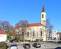
| Location | Ebergassing, Bruck an der Leitha District, Lower Austria, Austria | ||||
| Street address |
| ||||
| Heritage designation | |||||
 | |||||
Media in category "Pfarrkirche Ebergassing"
The following 3 files are in this category, out of 3 total.
-
 Ebergassing - Kirche (1).JPG 3,150 × 3,858; 10.45 MB
-
 Ebergassing - Kirche (2).JPG 3,159 × 2,554; 7.67 MB
-
 Ebergassing Katholische Pfarrkirche Maria Himmelfahrt 2011.jpg 506 × 768; 358 KB
.JPG)
