Category:Pfarrkirche Sankt Oswald in Freiland
Jump to navigation
Jump to search
| Object location | | View all coordinates using: OpenStreetMap |
|---|
parish church  | |||||
| Upload media | |||||
| Instance of | |||||
|---|---|---|---|---|---|
| Named after | |||||
| Location | Deutschlandsberg, Deutschlandsberg District, Styria, Austria | ||||
| Heritage designation | |||||
 | |||||
Subcategories
This category has the following 5 subcategories, out of 5 total.
Media in category "Pfarrkirche Sankt Oswald in Freiland"
The following 143 files are in this category, out of 143 total.
-
 2014-03-29 St Oswald Kirchenvorplatz.jpg 2,896 × 1,944; 5.72 MB
-
 2014-03-29 St Oswald Kloster.jpg 1,944 × 2,896; 5.89 MB
-
 2023-06-22 Pfarrkirche St Oswald in Freiland, Freistellungsarbeiten, Gebüschreste a.jpg 4,624 × 2,084; 11.35 MB
-

-

-
 2023-06-22 Pfarrkirche St Oswald in Freiland, Freistellungsarbeiten, Holz vor der Kirche.jpg 4,624 × 2,084; 8.29 MB
-

-

-

-

-

-
 2023-07-21 Pfarrkirche St Oswald in Freiland.jpg 6,016 × 4,016; 9.93 MB
-
 Allerheiligen So 2022-10-30 Musikkapelle Kloster.jpg 2,072 × 3,786; 8.45 MB
-
 Apsis St Oswald i Fr Nov 2020.jpg 3,096 × 4,128; 5.89 MB
-
 Fronleichnam 2018 Himmel Kirchenumgang quer.jpg 4,608 × 3,456; 13.86 MB
-
 Fronleichnam 2018 Himmel Kirchenumgang.jpg 3,456 × 4,608; 10.34 MB
-
 Gebiet der Pfarre St Oswald in Freiland 2018.jpg 958 × 579; 442 KB
-
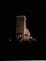
 Kirche St Oswald i Fr nachts.jpg 2,896 × 1,944; 4.31 MB
-
 Kirche Triftweber St Oswald 1911.jpg 6,638 × 4,258; 18.05 MB
-
 Kirchenkreuz 2023-03-26 St Oswald i Fr a.jpg 4,016 × 6,016; 12.55 MB
-
 Kirchenkreuz 2023-03-26 St Oswald i Fr b.jpg 4,016 × 6,016; 11.9 MB
-
 Kirchenkreuz Oswaldi 2018-08-05 a.jpg 3,456 × 4,608; 13.08 MB
-
 Kirchenkreuz St Oswald.jpg 2,896 × 1,944; 474 KB
-
 Kirchenvorplatz St Oswald i Fr Nov 2020.jpg 4,128 × 3,096; 21.23 MB
-
 Kirchturm St Oswald in Freiland 2017.jpg 3,456 × 4,608; 8.51 MB
-
 Kranz am Kriegerdenkmal St Oswald.jpg 3,456 × 4,608; 13.33 MB
-
 Kriegerdenkmal War Memorial Pfarrkirche Sankt Oswald in Freiland.jpg 3,397 × 5,095; 5.98 MB
-
 Name der Pfarre St Oswald in Freiland.jpg 9,459 × 5,342; 5.51 MB
-
 Oswald Kirche Stadl April 2020.jpg 4,128 × 3,096; 7.72 MB
-
 Personalstand 1817.jpg 3,295 × 2,664; 5.61 MB
-
 Personalstand 1889.jpg 3,618 × 2,740; 9.97 MB
-
 Personalstand 1893.jpg 3,590 × 2,724; 6.32 MB
-
 Pfarrerhebung Ordenspfarren Steiermark 1893.jpg 5,100 × 7,019; 10.53 MB
-
 Pfarrkirche Sankt Oswald in Freiland 03.jpg 3,813 × 5,719; 6.23 MB
-
 Pfarrkirche Sankt Oswald in Freiland 04.jpg 3,692 × 5,538; 5.81 MB
-
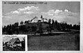
 Pfarrkirche Sankt Oswald in Freiland ca 1950.jpg 6,530 × 4,125; 15.08 MB
-
 Pfarrkirche Sankt Oswald in Freiland Kirchenvorplatz.jpg 3,456 × 4,608; 14.63 MB
-
 Pfarrkirche St Oswald ca 1950.jpg 3,342 × 2,140; 3.7 MB
-
 Pfarrkirche St Oswald in Fr freigestellt 2023-06-22 c.jpg 6,016 × 4,016; 10.32 MB
-
 Pfarrkirche St Oswald in Fr freigestellt 2023-06-22 d.jpg 6,016 × 4,016; 8.84 MB
-
 Pfarrkirche St Oswald in Fr freigestellt 2023-06-22 e.jpg 4,016 × 6,016; 9.85 MB
-
 Pfarrkirche St Oswald in Fr freigestellt 2023-06-22 f Apsis.jpg 4,016 × 6,016; 12.69 MB
-
 Pfarrkirche St Oswald in Fr freigestellt 2023-06-22 g Apsis Sakristeieingang.jpg 4,016 × 6,016; 11.8 MB
-
 Pfarrkirche St Oswald in Fr freigestellt 2023-06-22 h Apsis Missionskreuz.jpg 4,016 × 6,016; 12.51 MB
-
 Pfarrkirche St Oswald in Fr freigestellt 2023-06-22 i Apsis Missionskreuz.jpg 4,016 × 6,016; 13 MB
-
 Pfarrkirche St Oswald in Fr freigestellt 2023-06-22 j Apsis Missionskreuz schräg.jpg 4,016 × 6,016; 12.23 MB
-
 Pfarrkirche St Oswald in Fr freigestellt 2023-06-22 k Apsis Sakristeieingang.jpg 6,016 × 4,016; 12.45 MB
-
 Pfarrkirche St Oswald in Fr freigestellt 2023-06-22 l Nordwand mit Gelände.jpg 4,016 × 6,016; 12.39 MB
-
 Pfarrkirche St Oswald in Fr freigestellt 2023-06-22 m Nordwand mit Turm.jpg 4,016 × 6,016; 12.94 MB
-
 Pfarrkirche St Oswald in Fr freigestellt 2023-06-22 n Nordwand mit Turm.jpg 6,016 × 4,016; 11.54 MB
-
 Pfarrkirche St Oswald in Fr freigestellt 2023-06-22 o Nordwand Holzschlag.jpg 6,016 × 4,016; 12.57 MB
-
 Pfarrkirche St Oswald in Fr freigestellt 2023-06-22 p von Norden.jpg 4,016 × 6,016; 11.6 MB
-
 Pfarrkirche St Oswald in Fr freigestellt 2023-06-22 q Norden Holzschlag.jpg 6,016 × 4,016; 12.41 MB
-
 Pfarrkirche St Oswald in Fr freigestellt 2023-06-22 r Norden.jpg 6,016 × 4,016; 11.34 MB
-
 Pfarrkirche St Oswald in Fr freigestellt 2023-06-22 s Norden.jpg 6,016 × 4,016; 10.09 MB
-
 Pfarrkirche St Oswald in Fr freigestellt 2023-06-22 t Apsis.jpg 6,016 × 4,016; 12.37 MB
-
 Pfarrkirche St Oswald in Fr freigestellt 2023-06-22 u Holzschlag Norden.jpg 6,016 × 4,016; 11.49 MB
-
 Pfarrkirche St Oswald in Freiland 2021.jpg 6,016 × 4,016; 12.92 MB
-
 Pfarrkirche St Oswald in Freiland freigestellt 2023-06-22 a.jpg 6,016 × 4,016; 10.44 MB
-
 Pfarrkirche St Oswald in Freiland freigestellt 2023-06-22 b.jpg 6,016 × 4,016; 10.33 MB
-
 Pfarrkirche St Oswald in Freiland Grundbuchauszug.pdf 1,239 × 1,752; 61 KB
-
 Pfarrkirche St Oswald in Freiland Nacht.jpg 2,321 × 3,179; 5.87 MB
-
 Pfarrkirche St Oswald in Freiland Nov 2015.jpg 4,608 × 3,456; 14.68 MB
-
 Pfarrkirche St Oswald in Freiland Sakristeieingang.jpg 3,456 × 4,608; 6.56 MB
-
 Pfarrkirche St Oswald Nordwand.jpg 3,456 × 4,608; 12.7 MB
-
 Pfarrkirche St. Oswald 1.JPG 1,920 × 1,440; 700 KB
-
 Pfarrkirche St. Oswald in Freiland.JPG 1,944 × 2,896; 518 KB
-
 Pfarrpfründe St Oswald in Freiland Grundbuchsauszug.jpg 4,132 × 5,667; 3.23 MB
-
 RAD-Lager St Oswald 1939.jpg 1,511 × 928; 975 KB
-
 RAD-Lager Wolfsriegel.jpg 3,097 × 1,945; 3.75 MB
-
 Sakristei St Oswald i Fr Nov 2020.jpg 3,096 × 4,128; 8.8 MB
-
 Schwarzkogelrücken bis Moserjoslkogl.jpg 4,128 × 2,322; 1.52 MB
-
 Seelsorgeraum Schilcherland 2021 Seite 2.jpg 784 × 767; 155 KB
-
 Seelsorgeraum Schilcherland 2021.jpg 626 × 876; 186 KB
-
 St Oswald Freiland Kirche Pfarrerstadel.jpg 4,608 × 3,456; 7.98 MB
-
 St Oswald i Fr Oswaldiandacht Kirchenkreuz 2023-08-06.jpg 4,624 × 2,084; 4.44 MB
-
 St Oswald i Fr Oswaldiandacht Segen Kirchenplatz 2023-08-06.jpg 4,624 × 2,084; 5.9 MB
-
 St Oswald i Fr Triftweber Kirchturm ca 1960.jpg 6,973 × 4,920; 12.74 MB
-
 St Oswald i Freiland Kestenbraten und Turm Allerheiligen 2014 hoch.jpg 1,944 × 2,896; 6.06 MB
-
 St Oswald i Freiland Kestenbraten und Turm Allerheiligen 2014.jpg 1,944 × 2,896; 3.84 MB
-
 St Oswald i Freiland Kirche 13-12-2020 a.jpg 3,096 × 4,128; 8.21 MB
-
 St Oswald i Freiland Kirche 13-12-2020 b.jpg 3,096 × 4,128; 7.68 MB
-
 St Oswald i Freiland Kirchenvorplatz 13-12-2020.jpg 4,128 × 3,096; 8.66 MB
-
 St Oswald i Freiland Kriegerdenkmal.jpg 3,456 × 4,608; 7.82 MB
-
 St Oswald i Freiland Lourdesgrotte Musik.jpg 4,608 × 3,456; 10.86 MB
-
 St Oswald i Freiland Sakristei Allerheiligenabend 2014.jpg 2,896 × 1,944; 4.53 MB
-
 St Oswald i Freiland Südfront Kirche Turm 2.jpg 2,896 × 1,944; 4.52 MB
-
 St Oswald i Freiland Südfront Kirche Turm 3.jpg 3,456 × 4,608; 8.29 MB
-
 St Oswald i Freiland Südfront Kirche Turm.jpg 2,896 × 1,944; 4.8 MB
-
 St Oswald im Herbst 2.jpg 2,896 × 1,944; 1.08 MB
-
 St Oswald in Freiland 2023-06-22 am Horizont am Wolfsriegel Schwarzkogelzug.jpg 6,016 × 4,016; 14.91 MB
-
 St Oswald in Freiland 2023-06-22 am Horizont Wolfsriegel Schwarzkogelzug.jpg 6,016 × 4,016; 13.03 MB
-
 St Oswald in Freiland 2023-06-22 am Wolfsriegel Schwarzkogelzug.jpg 6,016 × 4,016; 21.02 MB
-
 St Oswald in Freiland 2023-06-22 Kirche im Schatten.jpg 6,016 × 4,016; 12.22 MB
-

-
 St Oswald in Freiland 2023-06-22 Kirche im Wald Wolfsriegel Schwarzkogelzug.jpg 6,016 × 4,016; 15.7 MB
-
 St Oswald in Freiland 2023-06-22 Kirche morgengrau.jpg 6,016 × 4,016; 8.69 MB
-
 St Oswald in Freiland 2023-06-22 Kirche schattengrau.jpg 6,016 × 4,016; 8.53 MB
-
 St Oswald in Freiland 2023-06-22 Kirchenhügel a.jpg 6,016 × 4,016; 16.17 MB
-
 St Oswald in Freiland 2023-06-22 Kirchenhügel b.jpg 6,016 × 4,016; 10.83 MB
-
 St Oswald in Freiland 2023-06-22 Kirchenhügel c.jpg 6,016 × 4,016; 12.29 MB
-
 St Oswald in Freiland 2023-06-22 Kirchenhügel d.jpg 6,016 × 4,016; 10.15 MB
-
 St Oswald in Freiland 2023-06-22 Kirchenhügel e.jpg 6,016 × 4,016; 12.71 MB
-
 St Oswald in Freiland 2023-06-22 Kirchenhügel f.jpg 6,016 × 4,016; 10.56 MB
-
 St Oswald in Freiland 2023-06-22 Kirchenhügel g.jpg 6,016 × 4,016; 10.63 MB
-
 St Oswald in Freiland 2023-06-22 Kirchenhügel h.jpg 6,016 × 4,016; 11.94 MB
-
 St Oswald in Freiland 2023-06-22 Kirchenhügel i.jpg 6,016 × 4,016; 12.29 MB
-
 St Oswald in Freiland 2023-06-22 Kirchenhügel j.jpg 6,016 × 4,016; 11.51 MB
-
 St Oswald in Freiland 2023-06-22 Kirchenhügel k.jpg 6,016 × 4,016; 10.49 MB
-
 St Oswald in Freiland 2023-06-22 Kirchenhügel l mit Pfarrhof.jpg 6,016 × 4,016; 10.37 MB
-
 St Oswald in Freiland 2023-06-22 Kirchenhügel m mit Pfarrhof.jpg 6,016 × 4,016; 11.02 MB
-
 St Oswald in Freiland 2023-06-22 Kirchenhügel m Pfarrhof Wohnhaus.jpg 6,016 × 4,016; 13.46 MB
-
 St Oswald in Freiland 2023-06-22 Kirchenhügel n.jpg 6,016 × 4,016; 9.44 MB
-
 St Oswald in Freiland 2023-06-22 Kirchenhügel o Kirchturm hinter Pfarrhof.jpg 6,016 × 4,016; 10.04 MB
-
 St Oswald in Freiland 2023-06-22 Kirchenhügel p Pfarrhof.jpg 6,016 × 4,016; 13.37 MB
-
 St Oswald in Freiland 2023-06-22 Kirchturm im Schatten.jpg 4,016 × 6,016; 9.6 MB
-
 St Oswald in Freiland 2023-06-22 Kirchturm Silhouette.jpg 4,016 × 6,016; 9.52 MB
-
 St Oswald in Freiland Kirche 4.jpg 1,924 × 2,520; 828 KB
-
 St Oswald in Freiland mit Reinischkogel von Osterwitz aus.jpg 2,896 × 1,944; 910 KB
-
 St Oswald in Freiland Nordseite.jpg 4,608 × 3,456; 7.92 MB
-
 St Oswald in Freiland Pfarrkirche Südfront.jpg 4,608 × 3,456; 11.62 MB
-
 St Oswald in Freiland Pfarrkirche Turm Allerheiligenabend.jpg 1,944 × 2,896; 3.59 MB
-
 St Oswald in Freiland Sakristei.jpg 4,608 × 3,456; 16.22 MB
-
 St Oswald Kirchenhügel 1918.jpg 6,302 × 4,072; 9.36 MB
-
 St Oswald Kirchenhügel 2018.jpg 4,608 × 3,456; 12.3 MB
-
 St Oswald Kirchenweg 2021.jpg 3,468 × 4,624; 6.42 MB
-
 St Oswald Lagergelände um 1960.jpg 4,483 × 2,502; 6.59 MB
-
 St Oswald Marienkapelle.jpg 1,927 × 2,895; 1.64 MB
-
 St Oswald Musikkapelle vor Kirche.jpg 1,024 × 768; 637 KB
-
 St Oswald Regen 2023-08-05 a.jpg 6,016 × 4,016; 11.56 MB
-
 St Oswald Regen 2023-08-05 b.jpg 6,016 × 4,016; 10.63 MB
-
 St Oswald Regen 2023-08-05 c.jpg 6,016 × 4,016; 9.59 MB
-
 St Oswald Schneetreiben.jpg 2,896 × 1,944; 2.84 MB
-
 St Oswald Sonnenuntergang 25-09-2018 b.jpg 4,128 × 3,096; 14.6 MB
-
 St Oswald Sonnenuntergang 25-09-2018 h.jpg 3,096 × 4,128; 9.57 MB
-
 St Oswald Sonnenuntergang 25-09-2018 i.jpg 3,096 × 4,128; 12.38 MB
-
 St Oswald Sonnenuntergang 25-09-2018.jpg 4,128 × 3,096; 7.11 MB
-
 St Oswald Turm 2019.jpg 3,096 × 4,128; 6.7 MB
-
 St Oswald Turm b 2019.jpg 3,096 × 4,128; 5.1 MB
-
 St Oswald Turm im Herbst.jpg 1,944 × 2,896; 941 KB
-
 St Oswald Turm und Kapellen Allerheiligenabend 2014.jpg 1,944 × 2,896; 4.4 MB
-
 Wegkapelle Fam Horvath.jpg 2,532 × 1,944; 507 KB
-
 Ziborium von St Oswald in Freiland.jpg 1,021 × 2,701; 459 KB


