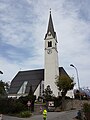
Category:Pfarrkirche St. Martin (Aldrans)
Jump to navigation
Jump to search
| Object location | | View all coordinates using: OpenStreetMap |
|---|
| This category shows the protected monument with the number 63836 in Austria. (Commons, de, Wikidata) |
|
This category shows the remarkable cultural object in the Austrian state of Tyrol listed by the Tyrolean Art Cadastre with the ID
54961. (on tirisMaps, pdf, more images on Commons, Wikidata) |
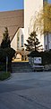
cemetery in Aldrans, Austria  | |||||
| Upload media | |||||
| Instance of | |||||
|---|---|---|---|---|---|
| Named after | |||||
| Location | Aldrans, Innsbruck-Land District, Tyrol, Austria | ||||
| Street address |
| ||||
| Heritage designation | |||||
 | |||||
Media in category "Pfarrkirche St. Martin (Aldrans)"
The following 12 files are in this category, out of 12 total.
-
 Aldrans, Pfarrkirche hoch.JPG 2,592 × 3,872; 3.07 MB
-
 Aldrans, Pfarrkirche.JPG 3,872 × 2,592; 2.86 MB
-
 Aldrans-parish church Saint Martin-01MSA.jpg 954 × 2,016; 222 KB
-
 Aldrans-parish church Saint Martin-02MSA.jpg 954 × 2,016; 287 KB
-
 Pfarrkirche St. Martin (Aldrans) Innenraum 2.jpg 4,032 × 3,024; 3.81 MB
-
 Pfarrkirche St. Martin (Aldrans) Innenraum1 2.jpg 4,032 × 3,024; 3.18 MB
-
 Pfarrkirche St. Martin (Aldrans) Kreuzwegbilder 1.jpg 4,032 × 2,268; 2.8 MB
-
 Pfarrkirche St. Martin (Aldrans) Kreuzwegbilder 2.jpg 4,032 × 2,268; 2.77 MB
-
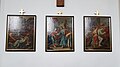 Pfarrkirche St. Martin (Aldrans) Kreuzwegbilder 3.jpg 4,032 × 2,268; 2.8 MB
-
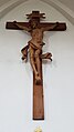 Pfarrkirche St. Martin (Aldrans) Kruzifix.jpg 2,268 × 4,032; 1.88 MB
-
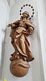 Pfarrkirche St. Martin (Aldrans) Madonna.jpg 2,268 × 4,032; 2.41 MB
-
 Pfarrkirche St. Martin (Aldrans) v S.jpg 3,024 × 4,032; 3.5 MB


_Innenraum_2.jpg)
_Innenraum1_2.jpg)
_Kreuzwegbilder_1.jpg)
_Kreuzwegbilder_2.jpg)
_Kreuzwegbilder_3.jpg)
_Kruzifix.jpg)
_Madonna.jpg)
_v_S.jpg)