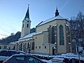
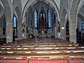
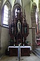
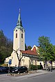
Category:Pfarrkirche St. Stephan (Amstetten)
Jump to navigation
Jump to search
| Object location | | View all coordinates using: OpenStreetMap |
|---|
church building in Lower Austria, Austria  | |||||
| Upload media | |||||
| Instance of | |||||
|---|---|---|---|---|---|
| Named after | |||||
| Location | Amstetten, Amstetten District, Lower Austria, Austria | ||||
| Heritage designation | |||||
 | |||||
| This category shows the protected monument with the number 27870 in Austria. (Commons, de, Wikidata) |
Deutsch: Bilder zur Pfarrkirche St. Stephan, Amstetten, Niederösterreich
Media in category "Pfarrkirche St. Stephan (Amstetten)"
The following 17 files are in this category, out of 17 total.
-
 2012.12.13 - Amstetten - Kath. Pfarrkirche hl. Stephan - 01.jpg 3,648 × 2,736; 3.97 MB
-
 2012.12.13 - Amstetten - Kath. Pfarrkirche hl. Stephan - 02.jpg 3,648 × 2,736; 3.07 MB
-
 2012.12.13 - Amstetten - Kath. Pfarrkirche hl. Stephan - 03.jpg 2,736 × 3,648; 5.45 MB
-
 2012.12.13 - Amstetten - Kath. Pfarrkirche hl. Stephan - 04.jpg 3,648 × 2,736; 5.56 MB
-
 2012.12.13 - Amstetten - Kath. Pfarrkirche hl. Stephan - 06.jpg 2,736 × 3,648; 5.14 MB
-
 2012.12.13 - Amstetten - Kath. Pfarrkirche hl. Stephan - 07.jpg 2,736 × 3,648; 5.25 MB
-
 2012.12.13 - Amstetten - Kath. Pfarrkirche hl. Stephan - 10.jpg 2,736 × 3,648; 5.64 MB
-
 2012.12.13 - Amstetten - Kath. Pfarrkirche hl. Stephan - 11.jpg 3,648 × 2,736; 2.78 MB
-
 Amstetten - Kirche St. Stephan.JPG 4,134 × 2,756; 9.78 MB
-
 Amstetten kosciol sw Szczepana.jpg 3,456 × 5,184; 4.72 MB
-
 Hochaltar St. Stephan Amstetten.jpg 3,168 × 4,752; 4.5 MB
-
 Linker Seitenaltar St. Stephan Amstetten.jpg 3,168 × 4,752; 5.9 MB
-
 Mosaik Pfarrhof St. Stephan Amstetten.jpg 3,168 × 4,752; 6.68 MB
-
 Orgel St. Stephan Amstetten 1.jpg 4,752 × 3,168; 5.91 MB
-
 Rechter Seitenaltar St. Stephan Amstetten.jpg 3,168 × 4,752; 5.75 MB
-
 St. Stephan Amstetten.jpg 3,168 × 4,752; 5.98 MB
-
 Taufbecken St. Stephan Amstetten.jpg 3,168 × 4,752; 6.59 MB


Categories:
- Cultural heritage monuments in Amstetten
- Buildings in Amstetten, Austria
- Saint Stephen churches in Lower Austria
- Churches in Bezirk Amstetten
- Churches in the Roman Catholic Diocese of Sankt Pölten
- Parish churches in Lower Austria
- Architectural basilicas in Lower Austria
- Pseudobasilicas in Lower Austria
- Religion in Amstetten, Austria