Category:Pfarrkirche Straß im Straßertale
Jump to navigation
Jump to search
| Object location | | View all coordinates using: OpenStreetMap |
|---|
church building in Straß im Straßertale, Austria   | |||||
| Upload media | |||||
| Instance of | |||||
|---|---|---|---|---|---|
| Named after | |||||
| Location | Straß im Straßertale, Krems District, Lower Austria, Austria | ||||
| Street address |
| ||||
| Heritage designation | |||||
 | |||||
Media in category "Pfarrkirche Straß im Straßertale"
The following 16 files are in this category, out of 16 total.
-
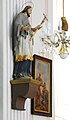 GuentherZ 2011-06-04 0005 Straß im Straßertal Kirche Statue Johannes Nepomuk.jpg 1,053 × 1,800; 665 KB
-
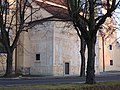
 GuentherZ 2011-06-04 0034 Strass im Strassertal Kirche.jpg 1,333 × 1,800; 998 KB
-
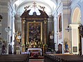
 Pfarrkirche Straß im Straßertale 01.jpg 4,752 × 3,168; 5.95 MB
-
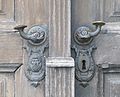 Strass im Strassertale Pfarrkirche Door handle 398.jpg 2,049 × 1,654; 2.49 MB
-
 Straß im Straßertale Marktplatz Pfarrkirche.jpg 4,288 × 2,848; 8.01 MB
-
 Straß im Straßertale Pfarrkirche1.jpg 2,736 × 3,648; 3.81 MB
-
 Straß im Straßertale Pfarrkirche10.jpg 3,000 × 4,000; 4.22 MB
-
 Straß im Straßertale Pfarrkirche11.jpg 4,000 × 3,000; 4.97 MB
-
 Straß im Straßertale Pfarrkirche2.jpg 3,648 × 2,736; 5.77 MB
-
 Straß im Straßertale Pfarrkirche3.jpg 3,648 × 2,736; 5.76 MB
-
 Straß im Straßertale Pfarrkirche4.jpg 2,736 × 3,648; 4.72 MB
-
 Straß im Straßertale Pfarrkirche5.jpg 3,648 × 2,736; 4.2 MB
-
 Straß im Straßertale Pfarrkirche6.jpg 4,000 × 3,000; 4.73 MB
-
 Straß im Straßertale Pfarrkirche7.jpg 4,000 × 3,000; 4.49 MB
-
 Straß im Straßertale Pfarrkirche8.jpg 3,000 × 4,000; 4 MB
-
 Straß im Straßertale Pfarrkirche9.jpg 3,000 × 4,000; 4.18 MB


