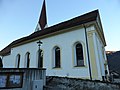
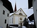
Category:Pfarrkirche hl. Margareta (Flaurling)
Jump to navigation
Jump to search
| Object location | | View all coordinates using: OpenStreetMap |
|---|
| This category shows the protected monument with the number 63975 in Austria. (Commons, de, Wikidata) |
|
This category shows the remarkable cultural object in the Austrian state of Tyrol listed by the Tyrolean Art Cadastre with the ID
19525. (on tirisMaps, pdf, more images on Commons, Wikidata) |
cemetery in Flaurling, Austria  | |||||
| Upload media | |||||
| Instance of | |||||
|---|---|---|---|---|---|
| Named after | |||||
| Location | Flaurling, Innsbruck-Land District, Tyrol, Austria | ||||
| Street address |
| ||||
| Heritage designation | |||||
 | |||||
Subcategories
This category has the following 2 subcategories, out of 2 total.
F
- Friedhof Flaurling (4 F)
Media in category "Pfarrkirche hl. Margareta (Flaurling)"
The following 8 files are in this category, out of 8 total.
-
 Außenansicht Kath. Pfarrkirche hl. Margareta.jpg 4,896 × 3,672; 2.18 MB
-
 Eingangsportal Kath. Pfarrkirche hl. Margareta.jpg 3,672 × 4,896; 6.59 MB
-
 Flaurling-Kath-Pfarrkirche-HlMargareta.jpg 2,560 × 1,920; 1.19 MB
-
 Hl. Margareta Flaurling-1.jpg 5,055 × 3,555; 2.2 MB
-
 Hl. Margareta Flaurling-2.jpg 4,540 × 3,590; 1.5 MB
-
 Hl. Margareta Flaurling-3.jpg 3,458 × 5,124; 1.28 MB
-
 Kath. Pfarrkirche hl. Margareta -2.jpg 4,896 × 3,672; 6.3 MB
-
 Vermauerte Eingangstür zur Kath. Pfarrkirche hl. Margareta, Flaurling.jpg 3,672 × 4,896; 6.61 MB


