Category:Römerbrücke (Lanzing)
Jump to navigation
Jump to search
| Object location | | View all coordinates using: OpenStreetMap |
|---|
bridge in Austria  | |||||
| Upload media | |||||
| Instance of | |||||
|---|---|---|---|---|---|
| Location | Dunkelsteinerwald, Melk District, Lower Austria, Austria | ||||
| Street address |
| ||||
| Heritage designation | |||||
 | |||||
Media in category "Römerbrücke (Lanzing)"
The following 10 files are in this category, out of 10 total.
-
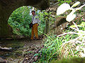
 Roemerbruecke-001.jpg 900 × 675; 430 KB
-
 Roemerbruecke-002.jpg 900 × 675; 389 KB
-
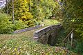
 Roemerbruecke-003.jpg 816 × 612; 242 KB
-
 Roemerbruecke-walter.jpg 1,000 × 750; 449 KB
-
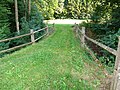 Roemerbruecke-weg.jpg 900 × 675; 437 KB
-
 Römerbrücke Bogen.jpg 3,104 × 4,672; 5.5 MB
-
 Römerbrücke komplett.jpg 3,104 × 4,672; 5.04 MB
-
 Römerbrücke Lanzing 2.jpg 3,008 × 2,000; 3.51 MB
-
 Römerbrücke Lanzing 3.jpg 3,008 × 2,000; 3.56 MB
-
 Römerbrücke Lanzing.jpg 3,008 × 2,000; 3.24 MB


