Category:St. Sebastian (Bad Blumau)
Jump to navigation
Jump to search
| Object location | | View all coordinates using: OpenStreetMap |
|---|
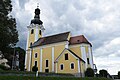
parish church .JPG) .JPG) | |||||
| Upload media | |||||
| Instance of | |||||
|---|---|---|---|---|---|
| Named after | |||||
| Location | Bad Blumau, Hartberg-Fürstenfeld District, Styria, Austria | ||||
| Street address |
| ||||
| Architectural style | |||||
| Heritage designation | |||||
| Inception |
| ||||
 | |||||
Subcategories
This category has only the following subcategory.
S
Media in category "St. Sebastian (Bad Blumau)"
The following 10 files are in this category, out of 10 total.
-
 Jahreszahlen über der Kirchentür von St. Sebastian.JPG 3,488 × 2,616; 2.21 MB
-
 Kirche Bad Blumau.jpg 4,640 × 2,610; 3.84 MB
-
 Pfarrkirche Bad Blumau 01.JPG 4,752 × 3,168; 6 MB
-
 Pfarrkirche bad blumau.JPG 2,592 × 3,872; 4.26 MB
-
 Sonnenuhr St. Sebastian Bad Blumau.JPG 3,488 × 2,616; 2.05 MB
-
 St. Sebastian (Bad Blumau).JPG 2,616 × 3,488; 1.99 MB
-
 St. Sebastian Pfarrkirche Bad Blumau 01.jpg 5,541 × 3,694; 5.77 MB
-
 St. Sebastian Pfarrkirche Bad Blumau 02.jpg 6,000 × 4,000; 13.04 MB
-
 St. Sebastian Pfarrkirche Bad Blumau 03.jpg 6,000 × 4,000; 12.64 MB
-
 Жовтень - panoramio.jpg 2,389 × 3,306; 2.93 MB


