Category:Wayside shrine John of Nepomuk, Breiteneich
Jump to navigation
Jump to search
| Object location | | View all coordinates using: OpenStreetMap |
|---|
 | |||||
| Upload media | |||||
| Instance of | |||||
|---|---|---|---|---|---|
| Location | Horn, Horn District, Lower Austria, Austria | ||||
| Heritage designation | |||||
 | |||||
| This category shows the protected monument with the number 73705 in Austria. (Commons, de, Wikidata) |
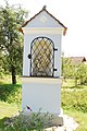
Deutsch: Bildstock hl. Nepomuk in Breiteneich
Media in category "Wayside shrine John of Nepomuk, Breiteneich"
The following 3 files are in this category, out of 3 total.
-
 GuentherZ 2012-07-28 0135 Breiteneich Bildstock Johannes Nepomuk.JPG 1,205 × 1,800; 1.42 MB
-
 GuentherZ 2012-07-28 0137 Breiteneich Bildstock Johannes Nepomuk.JPG 1,205 × 1,800; 771 KB
-
 GuentherZ 2012-07-28 0139 Breiteneich Bildstock Johannes Nepomuk.JPG 1,800 × 1,205; 1.83 MB

