Datei:Departments of Gabon.png
Zur Navigation springen
Zur Suche springen

Größe dieser Vorschau: 800 × 548 Pixel. Weitere Auflösungen: 320 × 219 Pixel | 640 × 439 Pixel | 1.024 × 702 Pixel | 1.281 × 878 Pixel
Originaldatei (1.281 × 878 Pixel, Dateigröße: 21 KB, MIME-Typ: image/png)
![]()
Diese Datei und die Informationen unter dem roten Trennstrich werden aus dem zentralen Medienarchiv Wikimedia Commons eingebunden.
![]()

|
This map has been uploaded by Electionworld from en.wikipedia.org to enable the |
Beschreibung
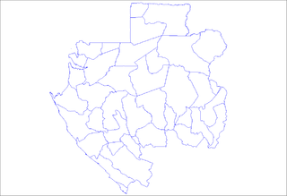
Map of the departments of Gabon. Created by Rarelibra for public domain use. Created using MapInfo Professional v7.5 and various mapping resources.
Lizenz
| Ich, der Urheberrechtsinhaber dieses Werkes, veröffentliche es als gemeinfrei. Dies gilt weltweit. In manchen Staaten könnte dies rechtlich nicht möglich sein. Sofern dies der Fall ist: Ich gewähre jedem das bedingungslose Recht, dieses Werk für jedweden Zweck zu nutzen, es sei denn, Bedingungen sind gesetzlich erforderlich. |
Dateiversionen
Klicke auf einen Zeitpunkt, um diese Version zu laden.
| Version vom | Vorschaubild | Maße | Benutzer | Kommentar | |
|---|---|---|---|---|---|
| aktuell | 21:17, 2. Jan. 2007 | | 1.281 × 878 (21 KB) | Rarelibra | Map of the departments of Gabon. Created by ~~~~ for public domain use, using MapInfo Professional v8.5 and various mapping resources. |
| 01:10, 28. Nov. 2006 |  | 1.087 × 860 (39 KB) | Electionworld | {{ew|en|Rarelibra}} == Summary == Map of the departments of Gabon. Created by Rarelibra for public domain use. Created using MapInfo Professional v7.5 and various mapping resources. == Licensing == {{PD-self}} [[Category:Maps of Gabon |
Dateiverwendung
Keine Seiten verwenden diese Datei.
Globale Dateiverwendung
Die nachfolgenden anderen Wikis verwenden diese Datei:
- Verwendung auf en.wikipedia.org
- Verwendung auf it.wikipedia.org
- Verwendung auf la.wikipedia.org
- Verwendung auf mk.wikipedia.org
- Verwendung auf pl.wikipedia.org
- Verwendung auf pt.wikipedia.org
- Verwendung auf ro.wikipedia.org
- Verwendung auf sw.wikipedia.org