Datei:Location of Madre de Dios region.png
Zur Navigation springen
Zur Suche springen
Es ist keine höhere Auflösung vorhanden.
Location_of_Madre_de_Dios_region.png (238 × 347 Pixel, Dateigröße: 30 KB, MIME-Typ: image/png)
![]()
Diese Datei und die Informationen unter dem roten Trennstrich werden aus dem zentralen Medienarchiv Wikimedia Commons eingebunden.
![]()
Beschreibung
| Beschreibung |
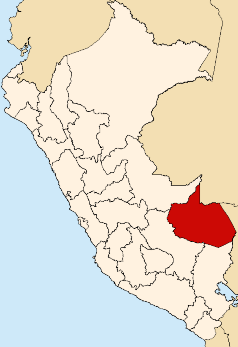
English: Map of Peru highlighting the Madre de Dios region |
| Datum | 24. Januar 2005 (Original-Hochladedatum) |
| Quelle | Eigenes Werk des ursprünglichen Hochladers |
| Urheber | Vanished user j123kmqwfk56jd in der Wikipedia auf Englisch |
Lizenz
| Diese Datei ist unter der Creative-Commons-Lizenz „Namensnennung – Weitergabe unter gleichen Bedingungen 3.0 nicht portiert“ lizenziert. Vorbehaltlich der Haftungsausschlüsse. | ||
| ||
| Diese Lizenzmarkierung wurde auf Grund der GFDL-Lizenzaktualisierung hinzugefügt. |

|
Es ist erlaubt, die Datei unter den Bedingungen der GNU-Lizenz für freie Dokumentation, Version 1.2 oder einer späteren Version, veröffentlicht von der Free Software Foundation, zu kopieren, zu verbreiten und/oder zu modifizieren; es gibt keine unveränderlichen Abschnitte, keinen vorderen und keinen hinteren Umschlagtext.
Der vollständige Text der Lizenz ist im Kapitel GNU-Lizenz für freie Dokumentation verfügbar. Vorbehaltlich der Haftungsausschlüsse. |
Ursprüngliches Datei-Logbuch
Die ursprüngliche Dateibeschreibungsseite war hier. Alle folgenden Benutzernamen beziehen sich auf en.wikipedia.
- 2005-01-24 04:46 Vanished user j123kmqwfk56jd 238×347× (30424 bytes) Map of Peru highlighting the Madre de Dios region
Dateiversionen
Klicke auf einen Zeitpunkt, um diese Version zu laden.
| Version vom | Vorschaubild | Maße | Benutzer | Kommentar | |
|---|---|---|---|---|---|
| aktuell | 20:49, 18. Okt. 2015 | | 238 × 347 (30 KB) | OgreBot | (BOT): Uploading old version of file from en.wikipedia; originally uploaded on 2005-01-24 04:46:37 by Vanished user j123kmqwfk56jd |
| 16:15, 7. Aug. 2005 |  | 238 × 347 (30 KB) | Rei-artur | Map of Peru highlighting the Madre de Dios region Created by Tuomas Carrasco - Jan. 2005 Source: en.wikipedia.org {{GFDL}} Category:Maps of Peru\ |
Dateiverwendung
Die folgende Seite verwendet diese Datei:
Globale Dateiverwendung
Die nachfolgenden anderen Wikis verwenden diese Datei:
- Verwendung auf ba.wikipedia.org
- Verwendung auf en.wikipedia.org
- Manu River
- Heath River
- Manu Province
- Tahuamanu Province
- Tambopata Province
- Salvación
- Iberia District
- Iñapari District
- Tahuamanu District
- Inambari District
- Laberinto District
- Las Piedras District
- Tambopata District
- Fitzcarrald District
- Madre de Dios District
- Manu District
- Huepetuche District
- Template:MadreDios-geo-stub
- Tambopata River
- Inambari River
- Los Amigos River
- Purús Communal Reserve
- Amarakaeri Communal Reserve
- Lake Sandoval
- Lake Valencia (Peru)
- Lake Sachavacayoc
- Verwendung auf fi.wikipedia.org
- Verwendung auf fo.wikipedia.org
- Verwendung auf id.wikipedia.org
- Verwendung auf ja.wikipedia.org
- Verwendung auf ka.wikipedia.org
- Verwendung auf ko.wikipedia.org
- Verwendung auf ms.wikipedia.org
- Verwendung auf pl.wikipedia.org
- Verwendung auf pt.wikipedia.org
- Verwendung auf ru.wikipedia.org
- Verwendung auf war.wikipedia.org